Most people who’ve heard of California’s Lost Coast picture themselves pinned against a cliff face at high tide, desperately consulting a laminated tide chart while the ocean swallows the only path forward. It’s a fair image. Honestly, it’s basically the defining experience of the famous beach route. But here’s the thing – there’s a whole other way to experience this extraordinary stretch of northern California, and it doesn’t require you to time your breakfast around the Pacific Ocean’s schedule.
The inland ridges of the King Range offer something rarer than dramatic beach walks. They offer perspective. Looking down at the ocean from a ridge is a completely different thing from walking along its edge, and the difference is one that most visitors to this region never discover. Let’s dive in.
Why the Lost Coast Is “Lost” in the First Place
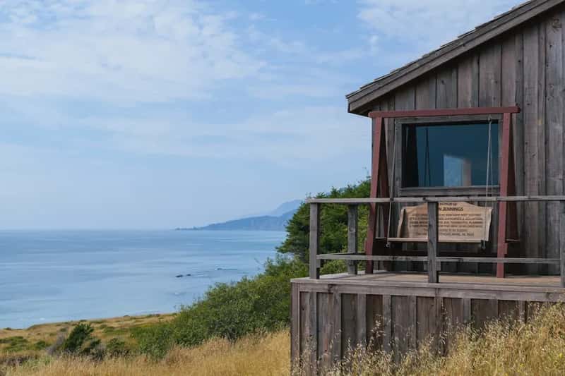
The Lost Coast got its name after the unforgiving terrain forced the Pacific Coast Highway to divert inland. Think about that for a moment. Engineers, facing one of the most iconic road-building projects in American history, simply gave up on this stretch and went around it.
Since the rigid land was too tough and costly to develop in the 1930s, the Lost Coast is now the only section of California’s coastline that remains untouched by the Pacific Coast Highway, which veers inland for 20 miles throughout this section.
The King Range NCA encompasses 68,000 acres along 35 miles of California’s north coast. Designated the nation’s first National Conservation Area in 1970, this strip of untamed coast was largely preserved due to its daunting nature. A place so stubborn it became protected by its own refusal to cooperate. There’s something poetic about that.
The Inland Ridge Option Nobody Talks About
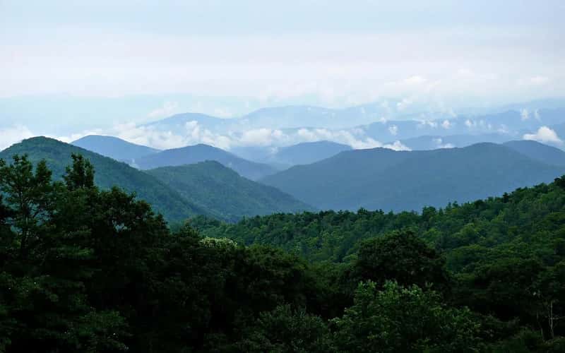
The King Range Wilderness offers 85 miles of backpacking opportunities on trails that traverse upland mountain ridges, coastal bluffs, and beaches. Most of the travel writing focuses heavily on that famous beach walk, but a substantial portion of that trail network climbs away from the water entirely.
One of the easier hikes in the King Range NCA rewards hikers with vistas of the coastline and inland mountain ranges from the 2,598-foot summit of Chemise Mountain. That’s a genuine Pacific Ocean view without a single tide chart required. Honestly, views from elevation hit differently than views from sea level.
The southern Lost Coast Trail rarely touches the beach, staying inland and skirting the tops of the bluffs most of the way. For those who want the scenery without the anxiety of tide windows, the inland ridge network is the answer that’s hiding in plain sight.
King Peak: The Crown of the Ridge
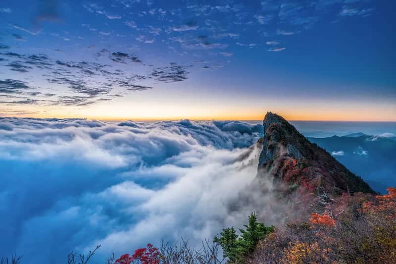
The King Range National Conservation Area is a spectacular meeting of land and sea as mountains thrust straight out of the surf with King Peak, at 4,088 feet, only three miles from the ocean. That proximity is almost hard to believe. Most mountains of that height are nowhere near the coast.
Upon arriving at King Peak, you are rewarded with panoramic views of the Pacific Ocean, King Crest, and mountainous redwood forests of Humboldt County’s interior. It is a genuinely rare combination. You get the ocean, the peaks, and the deep forest canopy all at once.
At an elevation of 4,000 feet and less than 3 miles from the ocean, King’s Peak provides stunning views in all directions: of canyons, beaches, foggy valleys, and the many greenhouses that dot the Humboldt County backcountry. Few summit views in California compress that much drama into one panorama. King’s Peak is perhaps the only coastal peak that can be compared to Big Sur’s Cone Peak, having almost the same awe-inspiring vistas but with none of the traffic – and even on a summer weekend you have a reasonable chance of having the trail and summit to yourself.
The King Crest Trail: Your Tide-Free Highway
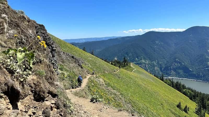
The King Crest Trail, a designated National Recreation Trail, offers a journey through the rugged and scenic King Range. This trail is known for its dramatic elevation changes and the challenges it presents to hikers. It’s not a stroll, but it is consistently spectacular.
The King Crest Trail North section runs from North Slide Peak Trailhead to King Peak, and much of the trail corridor burned in 2003, which has added endless vistas of the Lost Coast, Mattole Valley, and inland mountain ranges. Sometimes a wildfire does open things up in unexpected ways.
A two-to-three-day moderate to difficult hiking loop is a great alternative to the popular Lost Coast Trail, as it climbs to King Peak at 4,088 feet and descends to the beach, starting at the Saddle Mountain Trailhead with a gradual climb through a mixture of chaparral and forest, topping off with the spectacular King Peak vista. The loop format means you can sample the beach section briefly on your own terms, rather than planning your entire trip around the tide schedule.
What You’ll Actually See From Up There
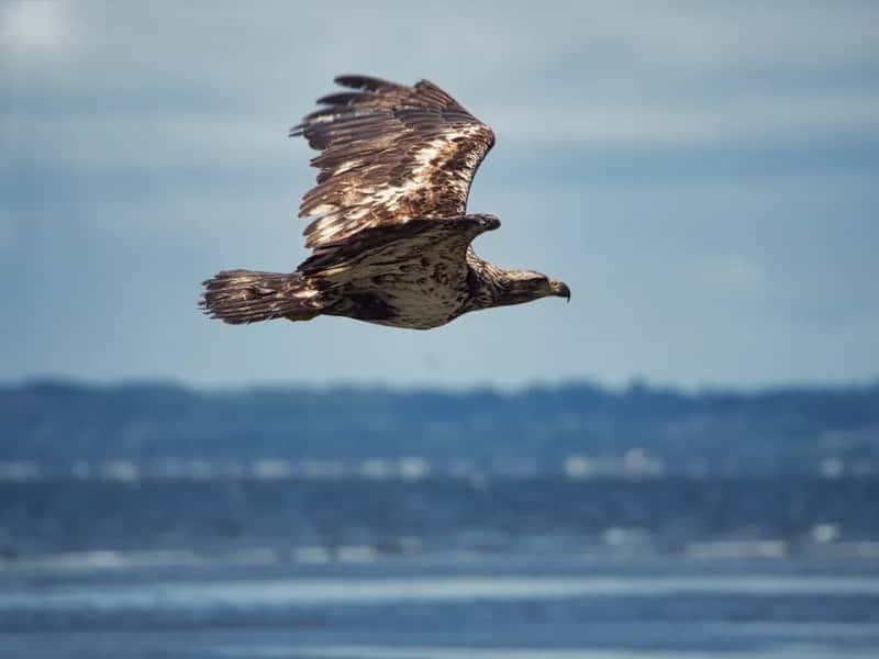
Hikers will be treated to exceptional wildlife viewing opportunities such as sea lions, elephant seals, river otters, eagles, bobcats, deer and more. The ridge puts you in prime position to spot peregrine falcons and bald eagles riding thermals above the Pacific. I think watching a raptor soar over an ocean from above is one of those sights that genuinely recalibrates your sense of scale.
Botanists consider the region’s dune system extremely unique in that the aggressive introduced European dune grass has not yet encroached, as it has on most coastal dunes north of San Francisco, and rare coastal ancient forests of Douglas fir, madrone, and tan oak dominate the Honeydew Creek watershed.
From the ridge route, you can see whales a few hundred yards offshore, barking sea lions, thousands of lizards, some snakes, deer, and more. The elevation actually improves your whale-watching odds, since you’re looking down at a wider angle of ocean rather than staring horizontally at the surf line. That’s a detail most guidebooks completely skip.
The Permit System and What It Means for Inland Hikers
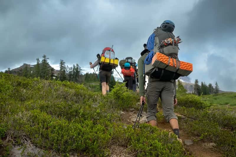
The BLM allows a total of 60 overnight backpackers per day from May 15 to September 15, and 30 per day the rest of the year. These permits apply to the King Range Wilderness overnight use. Permits are not required for day hiking.
Permits for a January 1 start date, for example, are released on October 1 of the prior year, and between 30 and 60 permits are released per day depending on the time of year – and they go very quickly. The demand is real and intense. Plan well ahead.
The King Range Wilderness Special Area Fee is based on the King Range Business Plan 2024 and a Federal Register Notice, with fees remaining in the King Range Wilderness to assist maintenance, stewardship, and education. Cell coverage is also spotty at best near the Lost Coast, with no coverage in Shelter Cove or at Mattole Beach. Download your maps before you leave civilization.
The Wildlife That Makes the Ridges Worth Protecting
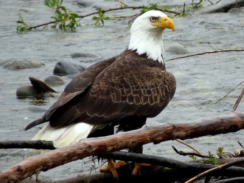
Endangered species in the King Range include leafy reedgrass, California brown pelican, steelhead trout, Chinook and coho salmon, bald eagle, peregrine falcon, northern spotted owl, and Roosevelt elk. That is an extraordinary density of protected species for one national conservation area.
The Honeydew Creek Wildlife Preserve protects 2,980 acres of habitat north of King Peak for bald eagle, northern spotted owl, mink, and anadromous fish. This preserve sits directly adjacent to the inland ridge trail network, making the upland routes some of the best wildlife habitat corridors in the area.
In 2024, the federal Fish and Wildlife Service adopted plans to reduce the number of barred owls in California, Oregon, and Washington to protect a pair of threatened owls, the northern spotted owl and California spotted owl. The King Range’s dense Douglas fir forests are a stronghold for spotted owl populations, which makes every visit to these ridges a kind of quiet solidarity with conservation work happening right now.
Weather, Rainfall, and the Ridge Season Sweet Spot
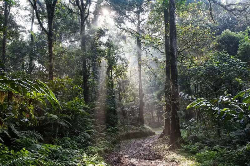
The area gets some of the highest rainfall totals in the continental United States, with over 100 inches of rain yearly in the Mattole River valley. That is not a typo. This place is genuinely soaked for a significant portion of the year, which explains both the lush ancient forests and the dramatic creek crossings.
The nicest time of year to hike the Lost Coast Trail is usually from late May to early October. The same window applies to the inland ridge routes, though the ridges tend to shed standing water faster than the beach sections after storms. Early fall is widely considered the sweet spot – fog clears faster, crowds thin out, and the light is extraordinary.
Heavy rains may cause downed trees or landslides along upland trails, and heavy rains may cause stream crossings to become hazardous and may impede travel. The BLM Visitor Center in the area can provide current conditions – you can contact the King Range Visitor Center at (707) 986-5400 or the Arcata Field Office at (707) 825-2300 for updates on current conditions.
Seismic Reality: The Ridge You’re Standing On Is Very Much Alive
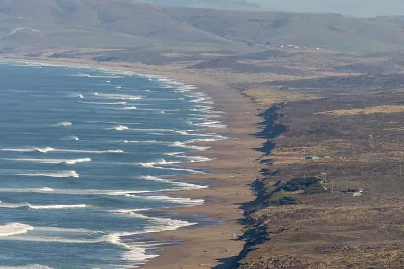
The Lost Coast is home to the Mendocino Triple Junction near Cape Mendocino and is one of the most seismically active regions in California. The mountains don’t just look dramatic. They are geologically active, which partly explains the extreme topography that defeated the highway engineers in the first place.
This seismic energy is also why the ridges are so steep and so close to the ocean. The land is essentially being pushed upward at a rate that outpaces coastal erosion. The Bureau of Land Management describes it as a spectacular meeting of land and sea, where the mountains seem to thrust straight out of the surf, a dramatic rise rarely surpassed on the continental U.S. coastline.
The BLM does not recommend hiking at night due to inherent dangers like slippery boulders, wildlife, and large waves, and notes that there have been many accidents, close calls, and deaths due to poor planning for impassable zones, marine conditions, and unfavorable weather. These are not casual warnings for legal cover. The terrain earns every bit of that language.
The Bigger Picture: Why the Lost Coast Ridge Matters in 2026
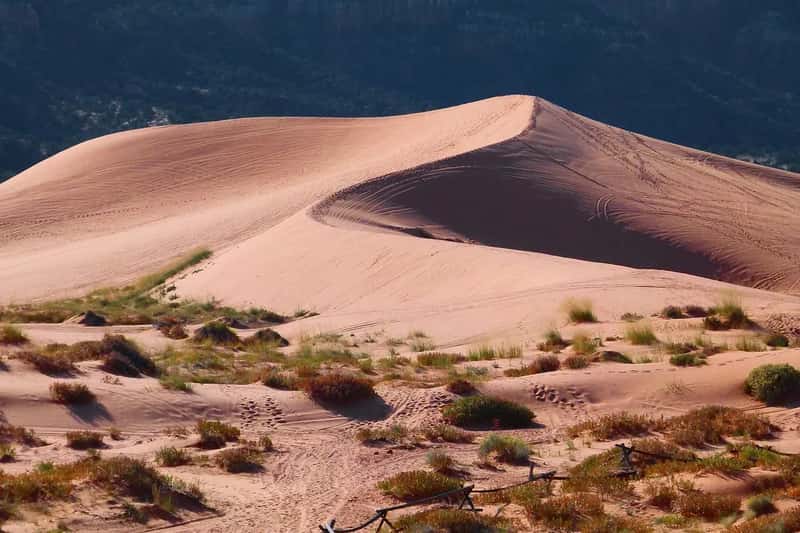
From beaches to high peaks commanding outstanding vistas, the King Range Wilderness is the wildest portion of the California coast – and indeed, the longest stretch of undeveloped coastline in the United States outside of Alaska. That fact alone should stop you in your tracks. Most people have no idea this place exists at this scale.
California remains the country’s top tourism destination. In 2024, California’s tourism industry generated $157.3 billion in visitor spending and contributed $12.6 billion in state and local tax revenue. Yet the inland ridges of the Lost Coast remain genuinely uncrowded, even as beach permits sell out within hours of release each October.
The coastline is so rugged that the state of California was unable to continue Highway 1 along this stretch and instead had to continue the highway inland – and unlike other areas of California, you won’t find mansions or homes tucked away on the cliffs along the beach. In a state where nearly every scenic spot has been monetized, fenced, or franchised, the Lost Coast inland ridge stands as something genuinely irreplaceable. The question isn’t whether it’s worth the effort. It’s whether you’re willing to look up from the tide charts long enough to find it.