Every national park looks like a postcard from the parking lot. Then you lace up, and the postcard starts making promises your legs never agreed to. Some of the biggest names in the system can be seen almost entirely on flat, paved paths, while others hide a brutal day behind one friendly-sounding trail name. Below, 24 parks are sorted into two camps: the ones that go easy on your knees, and the ones that quietly ask for far more.
Each numbered stop pairs one gentle park with one that doesn’t match its brochure. A few of the “easy” picks have a catch of their own, and a couple of the hard ones look harmless until you check the numbers. Hold your guess for the final pairing, because it features two of the most famous canyons in America, and neither plays by the rules you’d expect.
#12 – Acadia Lets You Stroll the Coast, but Yosemite’s Half Dome Can Eat 12 Hours
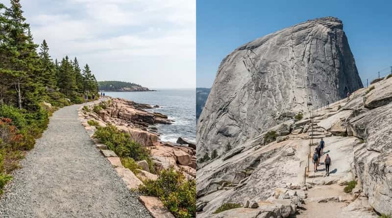
Acadia in Maine is one of the friendliest parks in the system. The Ocean Path is a mostly flat, scenic walk beside the rocky Maine coastline, and the Jordan Pond Path is regularly listed among the easier trails. Add the crushed-stone carriage roads, and you can fill a whole day without a single punishing climb. Your knees get a vacation, and the scenery doesn’t suffer for it.
Yosemite’s Half Dome is the opposite. The National Park Service describes it as a 14 to 16 mile round trip with roughly 4,800 feet of elevation gain, and most hikers need 10 to 12 hours. The finale is the cable section, and a permit is required while the cables are up, roughly late May to mid-October. In photos it looks like a short walk to a big rock. In person, it’s a full day your quads will remember for a week.
#11 – Yellowstone’s Bubbling Mud Pots Take Half a Mile, but Grand Teton’s Big Loop Takes Your Whole Day
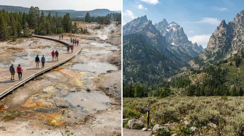
Yellowstone’s geysers sound like an expedition, yet the half-mile Fountain Paint Pot Trail is a boardwalk loop through hydrothermal features. You get bubbling mud, steaming vents, and a faint rotten-egg smell with almost no effort. Want a longer stroll? Fairy Falls is roughly 5 miles round trip on a mostly flat path and ends at a 200-foot waterfall. That’s a big payoff for a walk most people can finish in sneakers.
Grand Teton looks gentle from the lake, but the peaks rise almost straight off the valley floor with no foothills to warn you. The Paintbrush-Cascade Canyon loop is a roughly 20-mile route with thousands of feet of climbing and a high pass at Paintbrush Divide. Plenty of hikers split it over two days with a backcountry permit. The skyline is the easy part to admire. Getting up into it is the work.
Fast Facts
- Fountain Paint Pot Trail: about half a mile on a boardwalk loop.
- Fairy Falls: roughly 5 miles round trip, ending at a 200-foot waterfall.
- Paintbrush-Cascade Canyon: a roughly 20-mile loop with a high pass.
- Yellowstone became the nation’s first national park in 1872.
#10 – The Smokies Hide a Short Paved Walk, While Guadalupe Peak Is Texas’s Hardest Brag
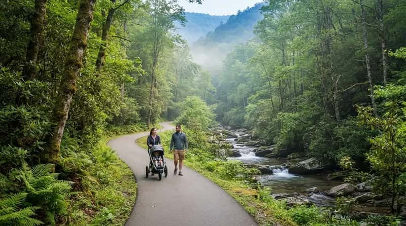
Great Smoky Mountains is the most visited park in the country, and most of those visitors never learn how gentle it can be. The Sugarlands Valley Nature Trail is a half-mile paved loop along the West Prong of the Little Pigeon River. You get the misty Appalachian forest feeling without climbing a ridge. It’s short, quiet, and easy to do with a stroller.
Out in West Texas, Guadalupe Mountains National Park holds the highest point in the state. Guadalupe Peak, at 8,751 feet, is about 8.4 miles round trip from Pine Springs with roughly 3,000 feet of climbing. It’s steep, rocky in places, and short on shade. Many hikers say it hits harder than longer trails with gentler grades, and the descent is where your knees file their complaint.
#9 – Bryce Canyon Gives You Hoodoos on a Short Paved Walk, but Shenandoah’s Old Rag Is a Scramble
Bryce Canyon is the park where you can feel like a mountaineer from a bench. The Rim Trail between Sunrise Point and Sunset Point is a half-mile paved stretch overlooking the largest concentration of hoodoos in the world. Those orange spires glow at sunrise, and you can admire them without breaking a sweat. In the busy season, a shuttle links the viewpoints too, so you can skip even the walking.
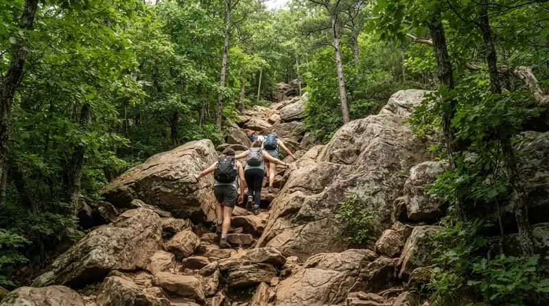
Shenandoah seems like a quiet Virginia drive along Skyline Drive, and then Old Rag happens. The 9.4-mile circuit is rated very strenuous, climbs roughly 2,400 feet, and takes most people 7 to 8 hours. Much of the day is boulder scrambling, not walking, and a day-use ticket is required during the busy season. It’s the park’s most famous hike for a reason. It’s also the one that sends people home limping.
Quick Compare
- Bryce Rim Trail: half a mile, paved, with a shuttle nearby.
- Old Rag: 9.4 miles, about 2,400 feet of climbing, 7 to 8 hours.
- The real gap: one is a bench-and-camera morning, the other is a full day of scrambling.
#8 – The Everglades Hands You a Boardwalk, but Longs Peak Demands a Pre-Dawn Alarm
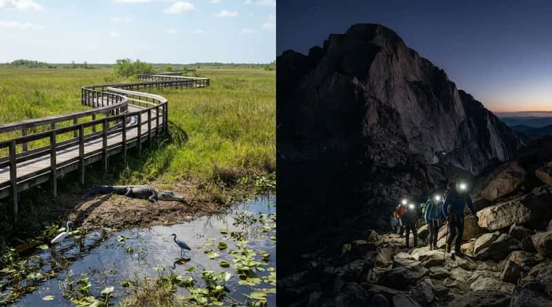
The Everglades has a reputation for swamp mud and mosquitoes. In reality, the Anhinga Trail is a roughly 0.8-mile round-trip walk on pavement and boardwalk, and it’s one of the best wildlife stops in the park. Alligators sunbathe a few feet from the path while wading birds hunt in the shallows. You don’t need hiking boots, just a camera and some bug spray.
Rocky Mountain National Park sits at the other extreme. Longs Peak is the park’s only fourteener at 14,259 feet, and the Keyhole Route runs about 14 to 15 miles round trip with roughly 5,100 feet of gain. Hikers typically start in the dead of night, often around 3 a.m., to be off the summit before the weather turns. Plenty of visitors who come for the scenic drives never learn this is the park’s real test.
#7 – Lassen Volcanic Offers an Eruption Walk, but Canyonlands Buries Its Hard Trails Far From the Pavement
Lassen’s volcanic past is easy to see without much effort. The Devastated Area Interpretive Trail is a half-mile paved loop through a landscape shaped by Lassen Peak’s 1915 eruption, and it works for wheelchairs and strollers. Boulders the size of cars were carried down the mountain in the aftermath. A few minutes of walking tells the whole violent story.
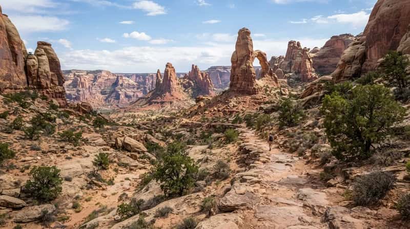
Canyonlands looks like a drive-and-gaze park from the overlooks at Island in the Sky. But the park is split into districts, and the farther you get from the pavement, the harder it gets. Druid Arch in The Needles is about 11 miles round trip, and The Maze is remote enough that the park recommends allowing at least three days. The park’s wildest sights sit far from the pavement.
#6 – Mount Rainier Has Wildflower Strolls, but Glacier’s Grinnell Trail Ends at a Shrinking Giant
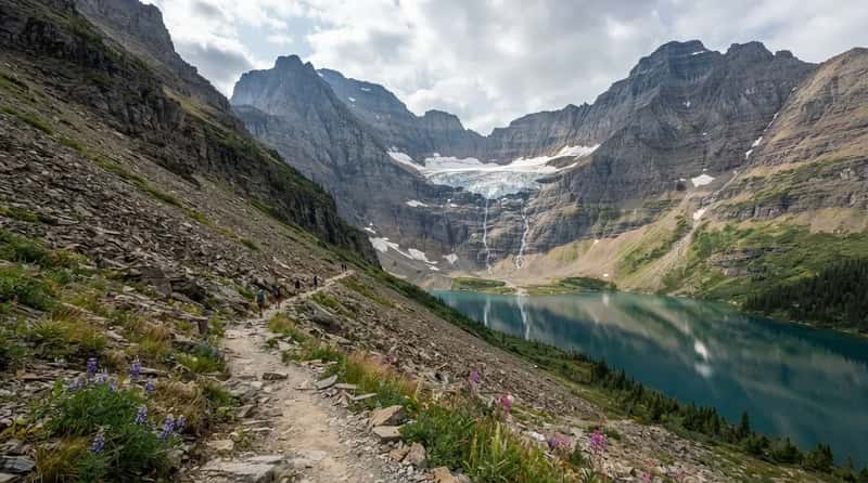
Mount Rainier is a 14,410-foot volcano that looks intimidating, yet some of its best views come on gentle paths. The Trail of the Shadows at Longmire is a short loop through forest, meadow, and mineral springs. The Nisqually Vista Trail at Paradise is a roughly 1.2-mile loop with views of the mountain, Nisqually Glacier, and the river valley. In summer, wildflowers can carpet the meadows, and the giant looms behind nearly every easy walk.
Glacier National Park rewards effort with a view that changes year to year. Grinnell Glacier is a 10.6-mile round trip with about 1,600 feet of gain, passing glacial lakes and ending at a shrinking glacier. The gain looks mild on paper. The distance is what wears people down. Pack layers, water, and bear spray, because the weather can swing fast in grizzly country.
At a Glance
- Rainier’s Nisqually Vista: about 1.2 miles, with a glacier view at the end of the loop.
- Rainier’s Trail of the Shadows: a short Longmire loop through forest and mineral springs.
- Grinnell Glacier: 10.6 miles round trip with about 1,600 feet of gain.
- Glacier packing basics: layers, water, and bear spray.
#5 – Mammoth Cave Has an Elevator Option, but Great Basin Takes Your Breath
Mammoth Cave surprises people who assume caves mean endless stairs. The accessible tour is designed for wheelchair users, with paved paths, ramps, and an elevator, and it should be reserved in advance. That gets you big formations and a look at the longest known cave system on Earth, with more than 400 miles mapped, without a staircase marathon. It’s a rare case where the underground is easier than the surface.
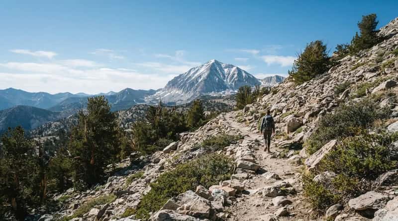
Great Basin in Nevada sounds remote and quiet, and it is. Wheeler Peak tops out at 13,065 feet, and the summit trail runs about 8.6 miles round trip. Altitude changes the difficulty of everything here. A trail that would be moderate at sea level feels very different in thin air, and your knees take the extra load on the way down. Up near the bristlecone pines, some of the oldest living trees on Earth, you’ll want to slow your pace.
#4 – Congaree’s Boardwalk Floats You Through a Forest, but Big Bend Punishes the Unprepared
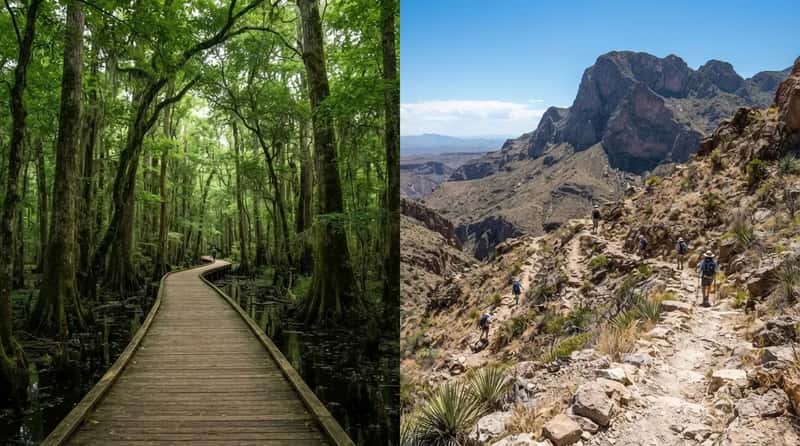
Congaree National Park in South Carolina protects one of the largest stretches of old-growth bottomland forest left in the Southeast. Its elevated Boardwalk Loop is about 2.4 miles, keeps you above the muddy floor, and stays flat the whole way. You walk beneath some of the tallest trees in the eastern United States, and the canopy is so thick the light turns green. It’s one of the lowest-effort ways to feel truly lost in nature.
Big Bend in Texas works the other way. The Chisos Mountains rise out of the Chihuahuan Desert, and the South Rim Loop is typically described as 12 to 14 miles. Heat, distance, and remoteness are the real obstacles here, not just the climbing. Running low on water out there can turn serious fast, which is why a start before sunrise matters more than fancy gear.
Worth Knowing
- Congaree’s Boardwalk Loop is about 2.4 miles, elevated, and flat.
- Big Bend’s South Rim Loop is typically described as 12 to 14 miles.
- The Chisos Mountains rise straight out of the Chihuahuan Desert, so heat is part of the climb.
- An early start and extra water matter more than fancy gear in Big Bend.
#3 – Redwood’s Giants Are an Easy Stroll, but North Cascades Hides Its Climbs in the Clouds
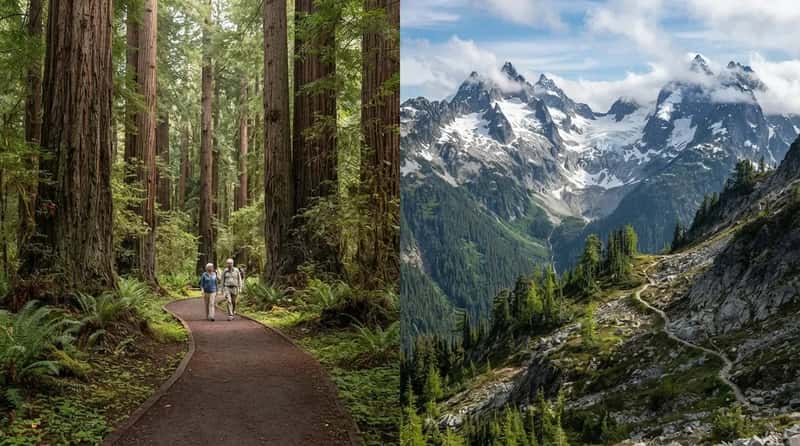
Redwood National and State Parks is home to the tallest trees on Earth. Short loops like the roughly 1.4-mile Lady Bird Johnson Grove trail take you into the grove on a gentle, well-groomed path. You feel tiny without having to work hard. For older visitors or anyone with cranky joints, it’s a gold-standard easy park.
North Cascades in Washington is the reverse. It sees far fewer visitors than the big-name parks, yet it holds more than 300 glaciers, more than any other U.S. park outside Alaska. The Cascade Pass trail alone climbs about 1,800 feet over roughly 7 miles round trip, and pushing on to Sahale Arm turns it into a very long day. Steep switchbacks and quick weather changes make it a serious mountain park. Think of it as a quieter place that asks for more.
#2 – Carlsbad Caverns Can Spare Your Knees, but Black Canyon Doesn’t Offer Many Gentle Ways In
Carlsbad Caverns has a built-in knee saver. You can walk down the steep Natural Entrance route, or you can take the elevator and stroll the Big Room loop. The Big Room is about 1.25 miles of mostly level path past giant formations. The elevator drops roughly 750 feet, which is a lot of downhill you get to skip. Come on a summer evening and you can catch the bats streaming out at dusk.
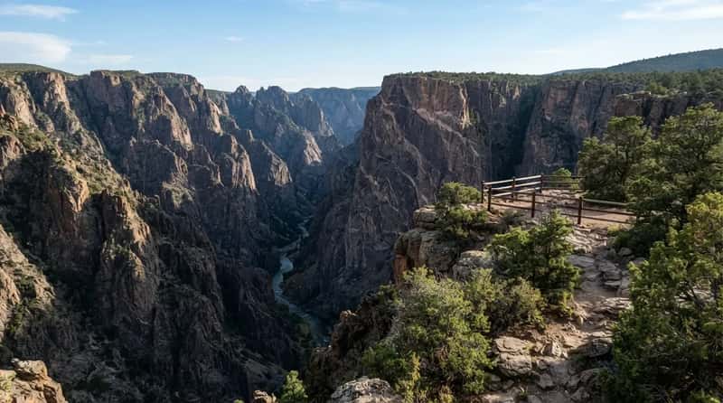
Black Canyon of the Gunnison in Colorado is narrow, dark, and deep, with walls that drop as much as 2,700 feet in places. Most visitors see it from the rim overlooks, and that’s the easy way. Routes into the canyon are steep, unmaintained, and not meant for casual hikers, and they require a permit. The rim feels calm. The inner canyon is a very different story.
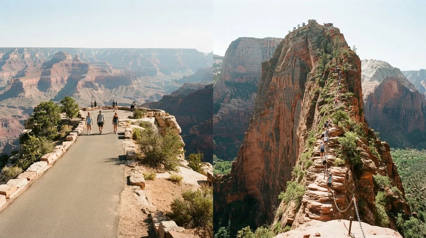
#1 – The Grand Canyon’s Rim Is Flat and Free, but Zion’s Angels Landing Is the Final Exam
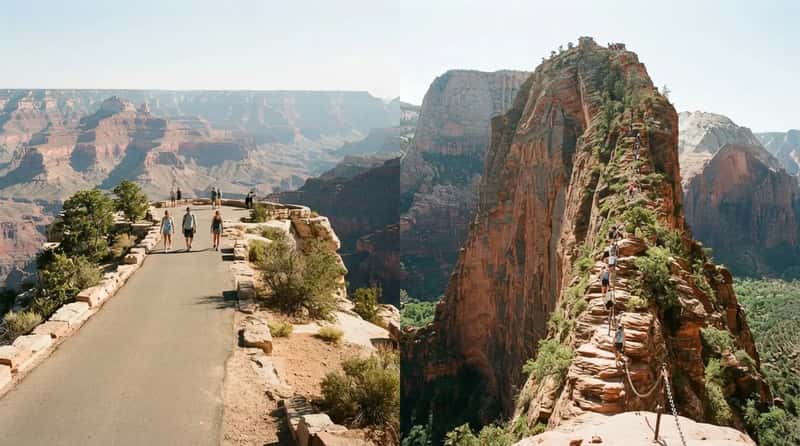
The Grand Canyon is the ultimate bait-and-switch in the best way. The Rim Trail runs for miles along the edge, mostly flat and largely paved, with nonstop views. The Trail of Time is a stretch of that path where each meter you walk equals a million years of geologic history. You can see the whole thing without descending a step. Going down is the part that trips people up. Bright Angel to Plateau Point is about 12 miles round trip and rated strenuous, and rangers warn that summer heat inside the canyon turns the climb back out into the hardest part.
Zion has both personalities in one canyon. The valley floor has the paved Riverside Walk, 2.2 miles round trip along the Virgin River. Then there’s Angels Landing, 5.4 miles round trip with about 1,500 feet of gain and a chain-assisted section across a ridge only a few feet wide in places. Permits are required and come through an online lottery. The distance sounds tiny, but the exposure is what makes it unforgettable.
The easy parks are real, and so is the work waiting in the others. The gap between the brochure and the boots almost always hides in a trail’s name, its altitude, or the one number nobody prints on the sign. One side gives you a postcard you can walk into. The other gives you a story you’ll still be telling years later, and your knees will know which is which.