The Grand Canyon is magnificent. Nobody’s arguing that. But somewhere along the way, America decided it was the only canyon worth talking about, and that’s where things went quietly, spectacularly wrong. Some of these 14 canyons are deeper. Some glow with colors that Arizona’s famous gorge can’t match. One of them is deeper than the Grand Canyon by nearly 2,000 feet – and most Americans have never heard its name.
These aren’t consolation prizes for people who couldn’t get a permit at the South Rim. They’re genuine geological wonders that happen to fly under the radar, some by geography, some by reputation, and a few just by sheer remoteness. A couple of them will genuinely stop you mid-scroll. Save this list – at least one of these is going on your bucket list before you reach the bottom.
#1: Hells Canyon, Oregon/Idaho – The Deepest Canyon in North America
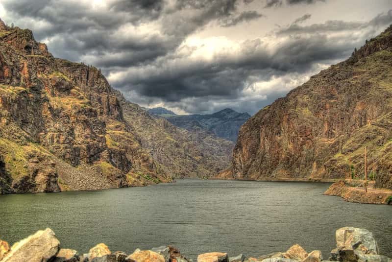
Here’s the one that always causes a double-take: Hells Canyon is deeper than the Grand Canyon. At 7,993 feet deep – nearly 2,000 feet deeper than the Grand Canyon – it is the deepest river gorge in North America, and most people have never heard its name. It straddles the borders of Oregon, Idaho, and Washington, roughly 10 miles wide, with the powerful Snake River thundering through its floor. The sheer scale of it doesn’t register until you’re standing at the rim and the other side looks impossibly far away.
The canyon sits inside the Hells Canyon National Recreation Area, which spans more than 1,000 square miles of wilderness. Ancient pictographs, petroglyphs, and arrowheads from Native American tribes who once called this gorge home still mark the canyon walls, adding a human layer to the backpacking experience. It’s remote enough that the crowds never come, which means the silence down there is almost physical. By almost every measurable standard, this is one of the greatest natural places on this continent – and it just sits there quietly, waiting.
Fast Facts
- Depth: 7,993 feet – deepest river gorge in North America
- Width: About 10 miles at its broadest point
- Length: Roughly 125 miles total, with 40 miles exceeding 1 mile deep
- River: Snake River, with Class II–V rapids throughout
- Access: Most of the canyon has no road crossings – true wilderness
#2: Santa Elena Canyon, Texas – Where the Rio Grande Disappears Into Limestone
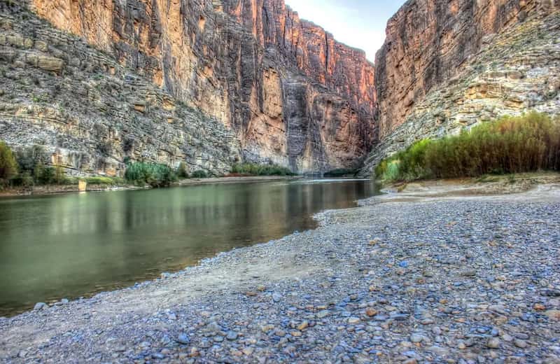
Santa Elena sneaks up on you. One minute you’re hiking through Chihuahuan Desert scrub inside Big Bend National Park, and the next you’re standing at the mouth of a canyon with limestone walls rising 1,500 feet straight up on both sides of the Rio Grande. The river here forms the border between the United States and Mexico, and the canyon walls pressing in from both countries create a corridor so tight it feels like the earth is swallowing the water whole. It is genuinely one of the most dramatic natural entrances in the country.
Big Bend is one of the most remote national parks in the lower 48, and that isolation is exactly what keeps Santa Elena so pristine. Paddle a canoe or raft through when conditions allow, and the experience shifts entirely – the walls echo the sound of the current back at you, and the limestone you’re floating past is older than almost anything you’ll ever touch. Standing inside that canyon as it closes in from both sides is the kind of moment people describe for years afterward. Most Americans will never make it out here. That’s their loss.
#3: Palo Duro Canyon, Texas – The Grand Canyon Nobody Outside Texas Knows About
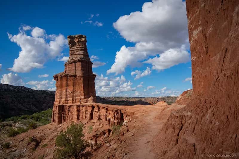
The second-largest canyon system in the United States sits in the Texas Panhandle and gets almost no national attention, which is baffling once you’ve seen it. Palo Duro Canyon runs roughly 25 to 40 miles long, reaches up to 20 miles wide in places, and drops around 800 to 1,000 feet through banded layers of orange, red, brown, yellow, and white rock representing more than 240 million years of geologic history. The colors are so vivid and so varied that first-time visitors genuinely stop and stare.
Palo Duro Canyon State Park draws around 400,000 visitors a year – impressive for a Texas state park, but shockingly low for a canyon this size and this beautiful. For comparison, the Grand Canyon sees roughly six million. The multicolored mesa walls and steep geological formations here have earned it the nickname “The Grand Canyon of Texas,” but that label undersells it. It deserves to be famous on its own terms, not as someone else’s stand-in.
#4: Black Canyon of the Gunnison, Colorado – Where Sunlight Is a Rare Guest
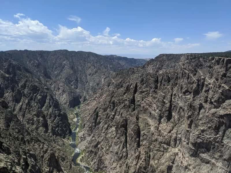
Some parts of the Black Canyon of the Gunnison receive only minutes of direct sunlight per day. Let that sink in. The canyon’s walls plunge more than 2,700 feet to the Gunnison River below, and the chasm is so steep and so narrow that the darkness inside it feels like a different atmosphere entirely. The rock faces are dark, striated, almost gothic – a complete visual contrast to the warm reds and oranges of Utah’s canyon country. Nothing else in America looks quite like this.
Located in western Colorado, Black Canyon is one of the least-visited national parks in the contiguous United States, which is remarkable given what it delivers. Hike the Rim Rock Trail for sweeping panoramic views, or descend into the Inner Canyon for one of the more demanding and rewarding wilderness experiences in the country. The darkness, the depth, the sound of the river echoing hundreds of feet below – this place feels like a canyon from another planet, and it’s within driving distance of much of the Mountain West.
At a Glance
- Depth: Over 2,700 feet to the Gunnison River
- Sunlight: Some inner sections receive as little as 33 minutes of direct sun per day
- Rock age: Some of the oldest exposed rock in North America – up to 1.7 billion years old
- Crowd factor: One of the least-visited NPS units in the lower 48
#5: Paria Canyon, Arizona/Utah – The Wave’s Quieter Neighbor
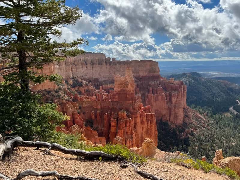
Most people who visit the Vermilion Cliffs region are chasing permits for “the Wave” – that hypnotic swirl of red and white sandstone that floods Instagram every season. But just next door, Paria Canyon delivers an equally stunning geological experience with a fraction of the foot traffic. Carved by the Paria River, a tributary of the Colorado, this deep and narrow canyon network runs alongside the Vermilion Cliffs escarpment and showcases the same striking red sandstone that defines the Arizona-Utah border country.
The canyon walls shift color through the day as light angles change, and the surrounding rock formations push into shapes that almost defy comprehension. The Paria Canyon-Vermilion Cliffs Wilderness Area requires permits and limits daily access, which keeps the experience intimate and the landscape unspoiled. If you’ve been turned away from Antelope Canyon by the crowds or the tour-group queues, Paria is the answer you didn’t know you were looking for.
#6: Royal Gorge, Colorado – Where the Canyon Drops 1,200 Feet Straight Down
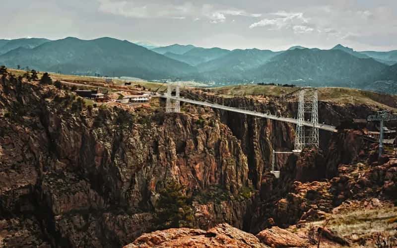
The Royal Gorge doesn’t sprawl. It plunges. While the Grand Canyon is famous for its breadth and layered grandeur, Royal Gorge is all vertical drama – sheer walls dropping 1,250 feet to the Arkansas River below, with a base only 50 feet wide in places. That extreme narrowness, combined with the depth, creates a sensation of standing at the edge of something that shouldn’t exist. The Arkansas River carved this slot through Precambrian granite over millions of years, and the results are almost uncomfortably impressive.
Spanning that gorge is the Royal Gorge Bridge, which held the title of the world’s highest suspension bridge from 1929 until 2001 – a full 1,053 feet above the river. Today, the park around it offers aerial gondola rides, ziplines across the canyon, and whitewater rafting on the Arkansas below. It’s one of those rare places that combines legitimate natural wonder with activities that will make your palms sweat. People often describe it as the moment they finally understood what “vertigo” actually feels like.
#7: Canyon de Chelly, Arizona – Living History on Canyon Walls
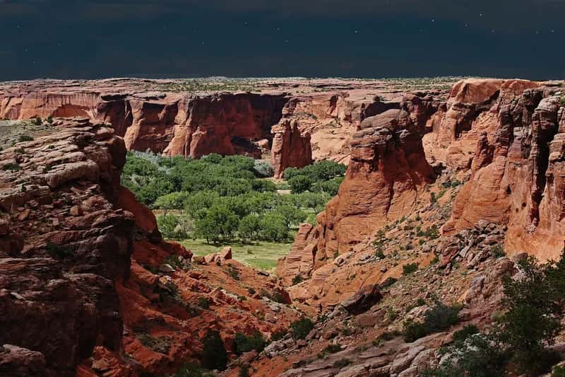
Canyon de Chelly (pronounced “de-SHAY”) is unlike any other canyon on this list – not just because of what you see, but because of who’s still here. Located on the Navajo Nation in northeastern Arizona, this sandstone-walled canyon preserves ancestral Puebloan cliff dwellings, ancient rock art, and thousands of years of continuous human presence. Some of the structures built into the canyon walls are nearly 1,000 years old and still look startlingly intact from the rim above.
Canyon de Chelly is entirely owned by the Navajo Nation and is the only National Park Service unit cooperatively managed in this way. About 40 Navajo families still live and farm on the canyon floor. Access to the canyon bottom is restricted – you can only enter with a park ranger or an authorized Navajo guide. That intimacy, sharing the canyon floor with people whose ancestors built the cliff dwellings above you, is an experience the Grand Canyon simply cannot replicate. This one leaves a mark.
Worth Knowing
- The Navajo Nation owns the land entirely – unique among all NPS-managed sites
- Around 40 Navajo families still actively live and farm on the canyon floor today
- Canyon bottom access requires a park ranger or authorized Navajo guide
- Cliff dwellings here date back nearly 1,000 years and remain remarkably intact
- Admission to the rim overlooks and visitor center is free
#8: Buckskin Gulch, Utah – The Longest Slot Canyon on Earth
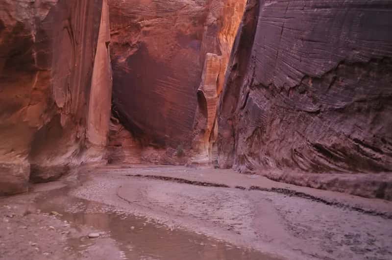
Imagine squeezing through a passageway a few feet wide with walls rising up to 500 feet on either side, banded in every shade of red, orange, and pink sandstone the earth can produce. That’s Buckskin Gulch – approximately 16 miles long and widely regarded as the longest slot canyon in the world, cutting through the Paria Canyon-Vermilion Cliffs Wilderness. Ancient petroglyphs mark the walls in places, and sections of the canyon floor require scrambling over boulders or wading through shallow pools left by the last storm.
Permits are required for both day hiking and overnight trips, and overnight spots are limited and can sell out months in advance. That strict limitation is exactly what keeps Buckskin Gulch as pristine and as quiet as it is. There are sections of this canyon where no sunlight reaches the floor at all, and the colors in that filtered half-light are something a photograph genuinely struggles to capture. If you’ve ever wanted to feel absorbed by a canyon rather than just impressed by it, this is where you go.
#9: Canyonlands National Park, Utah – Four Worlds in One
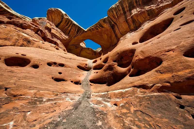
Canyonlands covers 337,598 acres in the heart of Utah’s high desert and is split by the Colorado and Green rivers into four completely distinct districts. Island in the Sky offers the most accessible viewpoints, while The Needles demands more hiking and four-wheel driving. The Maze lives up to its name – it’s one of the most remote and disorienting landscapes in the lower 48, and inexperienced hikers genuinely get lost there. Each district feels like a separate canyon experience, which is part of what makes Canyonlands so quietly extraordinary.
The detached Horseshoe Canyon unit is worth the long dirt-road drive for one reason: the Great Gallery. This massive pictograph panel, painted by ancient people thousands of years ago, is one of the most significant pieces of rock art in North America – ghostly, haunting human figures that fill an entire canyon wall. There are also fossilized dinosaur tracks along the trail. Canyonlands sees a fraction of Zion’s crowds despite delivering something far more raw and far less curated. That’s either its greatest flaw or its greatest feature, depending on who you ask.
Quick Compare: Canyonlands Districts
- Island in the Sky – Paved road access, sweeping Mesa Arch views, best for first-timers
- The Needles – Spire-filled backcountry, great hiking and 4WD routes
- The Maze – Extremely remote, no marked trails, for experienced desert navigators only
- Horseshoe Canyon – Detached unit; home to the Great Gallery rock art panel
#10: Letchworth State Park, New York – The Grand Canyon of the East
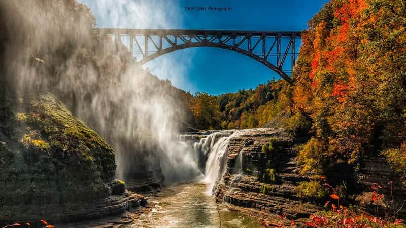
Most people who’ve never been to western New York picture flat farmland and lake-effect snow. They do not picture a 550-foot-deep gorge carved by the Genesee River, flanked by three thundering waterfalls and miles of dense forest. Letchworth State Park earns its “Grand Canyon of the East” nickname every time someone rounds a trail bend and stops dead in their tracks. The scale of it is genuinely shocking for a state park in the Northeast.
The park follows the Genesee River north through the gorge, with the Upper, Middle, and Lower Falls each offering a completely different character – the Middle Falls alone drops 107 feet into a wide pool surrounded by cliff walls. In autumn, when the surrounding hardwood forest turns, the canyon walls frame a color display that travel writers routinely describe as one of the most beautiful scenes east of the Mississippi. People plan a quick afternoon visit and end up staying until the rangers close the gates.
#11: Waimea Canyon, Hawaii – The Pacific’s Best-Kept Secret
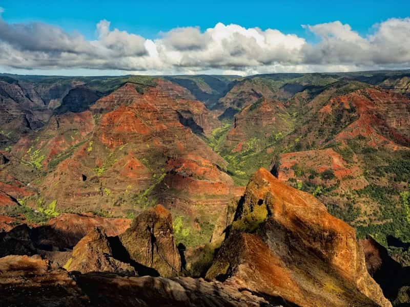
When most people think of Kauai, they picture beaches, Na Pali Coast sea cliffs, and maybe a helicopter tour. Waimea Canyon, on the island’s western side, tends to get treated as a scenic detour on the way to something else. That’s a mistake. At roughly 14 miles long, about a mile wide, and plunging to depths of more than 3,600 feet, Waimea Canyon is a full-scale geological spectacle – rich reds, deep browns, and tropical greens layered between cascading waterfalls and sheer volcanic cliffs.
The canyon is often called the “Grand Canyon of the Pacific,” and the comparison holds up visually while underselling what makes Waimea distinct. Unlike most major canyons carved through sedimentary rock, Waimea cuts through ancient basaltic lava flows, producing a color combination – vivid green against dark red volcanic rock – that the drier Southwest simply cannot produce. Most Kauai visitors head straight for the beaches and never make it to the western side of the island. The canyon rewards the ones who do with one of the most visually dramatic overlooks in the entire United States.
Fast Facts
- Depth: More than 3,600 feet – the largest canyon in the Pacific islands
- Length: Approximately 14 miles long, about 1 mile wide
- Rock type: Basaltic lava flows, not sedimentary – unique among major U.S. canyons
- Formed by: Volcanic collapse roughly 4 million years ago, plus river erosion
- Admission: Free; accessed via Waimea Canyon Drive (Hwy 550)
#12: Grand Canyon of the Yellowstone, Wyoming – Waterfalls Included
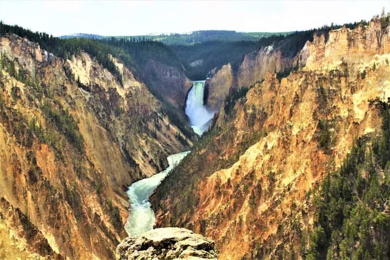
Inside Yellowstone National Park, most visitors are watching geysers and hunting for bison. The ones who drive to the canyon rim are the ones who go home with the best photographs. The Yellowstone River plunges over two waterfalls in rapid succession – the Upper Falls at 109 feet and the Lower Falls at 308 feet, nearly twice the height of Niagara – before racing through a 24-mile gorge of pastel yellow, orange, and white canyon walls that look almost hand-painted. The color comes from ancient hydrothermal activity that chemically altered the rhyolite rock beneath the surface.
The canyon runs between 800 and 1,200 feet deep and up to three-quarters of a mile wide, with a network of rim trails and overlooks that reveal new angles with every turn. Artist Point, on the south rim, is one of the most reproduced landscape views in the history of American painting – Thomas Moran’s 19th-century canvases of this exact view helped convince Congress to create the first national park. Standing there now, looking at the Lower Falls roaring into a canyon of impossible color, it’s easy to understand why.
#13: Zion Canyon, Utah – Red Walls That Don’t Quit
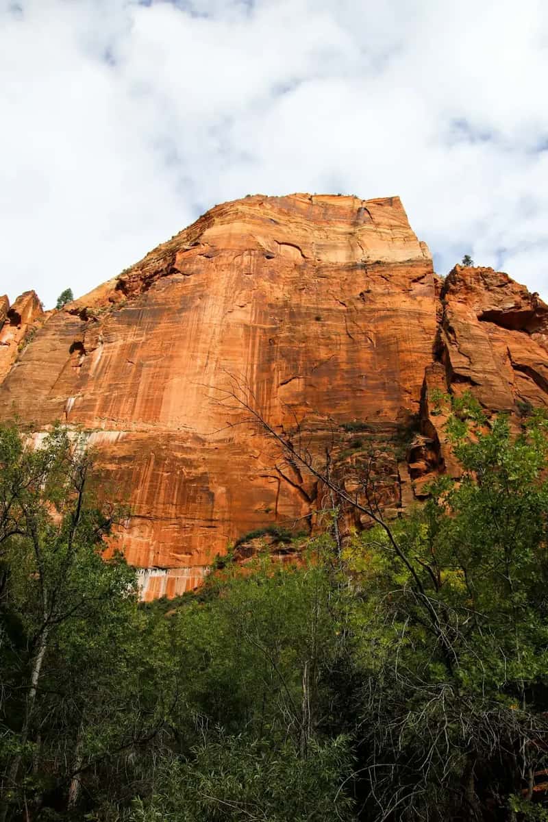
Zion Canyon is technically one of the most visited canyons in the country, but it earns its place here because of how many people visit the park and still don’t fully reckon with what the canyon itself is. The sandstone walls in Zion’s main gorge reach up to 2,000 feet and close in from both sides with a scale that no photograph adequately prepares you for. You feel small here in a way that’s almost physical – a reminder of exactly how long these rocks have been standing and exactly how briefly you’ll be passing through.
The Narrows hike, where the canyon compresses into a corridor just wide enough for the Virgin River and a single hiker, is one of the most memorable trail experiences in the American West. You wade upstream through cold water with walls towering more than 1,000 feet overhead and slender slivers of sky visible above. It’s wet, it’s cold in spots, and it’s the kind of hike people talk about for the rest of their lives. Arrive early – the park fills its parking lots before 8 a.m. on busy summer mornings.
#14: Glenwood Canyon, Colorado – The One You Drive Right Through Without Realizing It
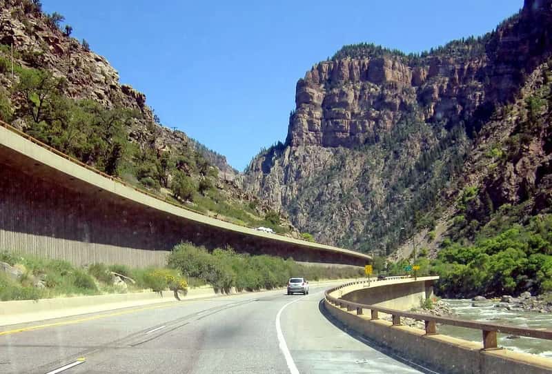
Millions of people travel through Glenwood Canyon every year on I-70 without fully registering what they’re looking at. The highway snakes through a narrow limestone gorge carved by the Colorado River near Glenwood Springs, with sheer walls rising hundreds of feet on both sides and the river running alongside the road the entire way. It’s one of the most dramatic highway corridors ever built in the United States – engineers spent 12 years and nearly $490 million threading I-70 through terrain that seemed impossible to cross.
The real experience, though, is off the highway. The canyon itself offers a bike trail running its full length along the river, whitewater rafting through legitimate Class IV rapids, and overlooks that most drivers never stop to find. The Colorado River has been carving through this stretch of rock for millions of years, and the results are quietly spectacular at every bend. Most people blow through on their way to ski resorts and never stop. That’s honestly their loss – an hour by the water here is something you’ll remember far longer than whatever you were rushing toward.
Why It Stands Out
- One of the most expensive highway projects in U.S. history – nearly $490 million to build
- 12 years of construction just to thread I-70 through the canyon walls
- A paved bike trail runs the full length of the gorge along the river
- Class IV whitewater rapids make it a serious rafting destination, not just a drive-through
- Most visitors never stop – which means the riverside trails are genuinely uncrowded
America’s canyon country is so vast and so varied that its most famous example isn’t the deepest, the longest, the narrowest, or even the most colorful. These 14 places prove that the real adventure usually starts the moment you leave the postcard version behind. Which one is already on your list – and which one genuinely stopped you cold?