
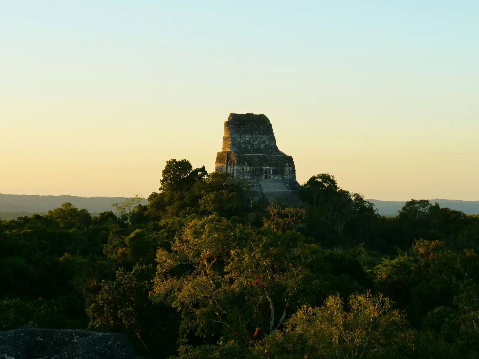
Tikal, Guatemala – Few ancient cities feel as far from the modern world as Tikal National Park, which lies in the forests of northern Guatemala. It was once one of the most powerful centers of the Maya world, yet the jungle reclaimed its temples so completely that the site stayed hidden for centuries. A recent travel guide describes the ruins as a place where the remote setting makes the experience feel untouched and distinct ([1]). That combination of hidden history and wilderness explains why the site draws travelers from around the world. ([1])
A City the Forest Almost Erased
Tikal’s peak came during the Classic Period, which ran roughly from 200 to 900 CE, when the city served as a political, economic, and military hub. Tikal’s decline began around the 10th century, and the city was eventually abandoned. Over the following centuries, vegetation gradually buried the stone buildings. The site was not formally rediscovered until 1848, and serious excavation did not begin until the 1960s.
The city’s original name is generally thought to have been Yax Mutal, though the modern name Tikal comes from later archaeologists. Today many structures remain only partly uncovered. Despite being Guatemala’s largest archaeological Maya site, many of the temples in Tikal National Park remain unexcavated. That unfinished quality gives visitors the sense that the forest is still keeping some of its secrets.
Why the Remote Setting Sets It Apart
The isolation of Tikal is not just a matter of atmosphere. In 1951, a small airstrip was built at the ruins, which previously could only be reached by several days’ travel through the jungle on foot or mule. Before that, reaching the site required a slow journey that few outsiders attempted.
The protected area followed soon after. It was created on 26 May 1955 under the auspices of the Instituto de Antropología e Historia and was the first protected area in Guatemala. The park is part of a much larger forest. This forest, often called the Maya Forest, stretches across Guatemala, Belize, and southern Mexico. UNESCO recognized the site in 1979, and the surrounding forest remains essential to its ecological value.
Tikal at a glance
- Location: Petén region of northern Guatemala, near the town of Flores
- Peak period: the Classic Period, roughly 200 to 900 CE
- Landmark temples: some rise more than 60 meters above the jungle canopy
- Protected since 1955, and a UNESCO World Heritage Site since 1979
Planning a Visit Without Losing the Magic
Most travelers base themselves in Flores, a lakeside town about 65 kilometers away. The drive usually takes around 1.5 hours. You get there three ways: a shared shuttle (cheapest and most common), a local colectivo from the Santa Elena bus station, or an organized tour with a guide. Visitors arriving from the United States can fly into the Mundo Maya International Airport (FRS) in Flores, Guatemala, which is the closest airport to the site.
Timing matters. The park is open daily from six in the morning to six at night, with a special pre-dawn entry from four for the sunrise. Many people opt for early tours, since the midday heat can be intense. Tickets for sunrise tours are typically purchased the day before. Mobile coverage is limited inside the park, so visitors should arrange tickets and transport while still in Flores. For those who want more time among the ruins, lodges near the entrance offer an overnight option.
Related Stories From Travelbinger



What Makes the Journey Memorable
Tikal’s appeal rests on contrast. Visitors move from a bustling lakeside town into a forest where the sounds of wildlife replace traffic, then climb ancient stone steps toward temple tops that rise above the trees. The site’s remoteness is what keeps it from feeling like a conventional tourist attraction.
For travelers seeking a destination that still feels like a discovery, Tikal offers a rare mix of archaeology and wilderness. Those who plan ahead, arrive early, and take time to explore the quieter corners of the park often leave with the sense that they found something few other places can match.