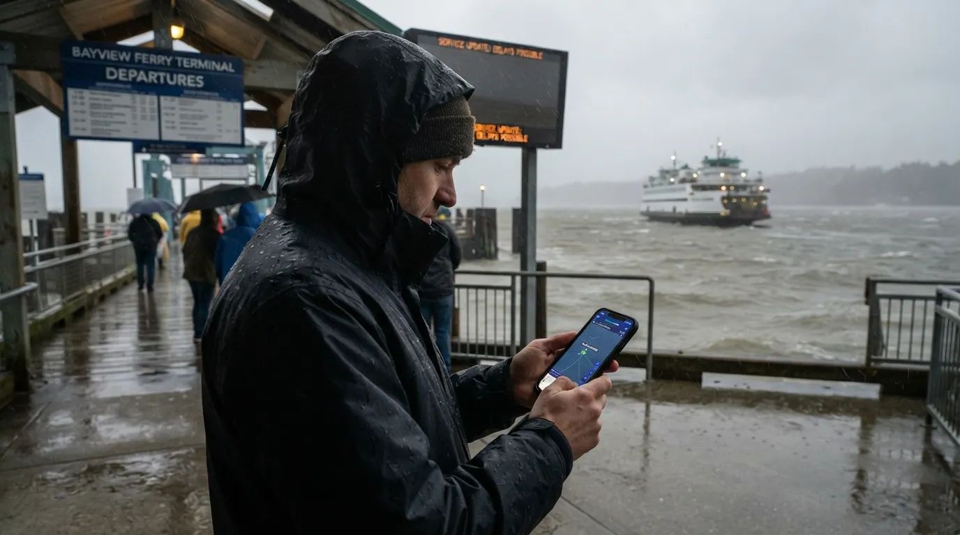
Most people picture a ferry terminal as rows of plastic chairs and a flickering departures board. Strip away the calm, and it turns into something almost unrecognizable – a place where wind speed, tide charts, and split-second judgment calls decide who gets home tonight.
The real data from ports, Coast Guard reports, and the crews who work these docks tells a story most travelers never see. It starts hours before the first raindrop falls, and it doesn’t end when the wind finally dies down.
#10 – The Calm That Isn’t Calm: Hours Before It Hits
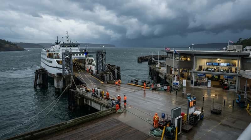
The storm hasn’t arrived yet, but the terminal is already changing shape. Forecasting tools track storm trajectories, wind speeds, and sea conditions in real time, and operators are watching every second of it.
When severe weather is expected, operators post disruption alerts through their systems and websites. That notice is the first signal to passengers that normal life is about to pause.
Maintenance crews walk the docks. Vessels get moved to safe locations or lashed down to survive what’s coming.
The coffee-and-commute atmosphere is gone, replaced by something quieter and sharper. What most passengers never realize is that this window is where bad outcomes get prevented – or locked in.
#9 – The Ramps That Simply Stop Working
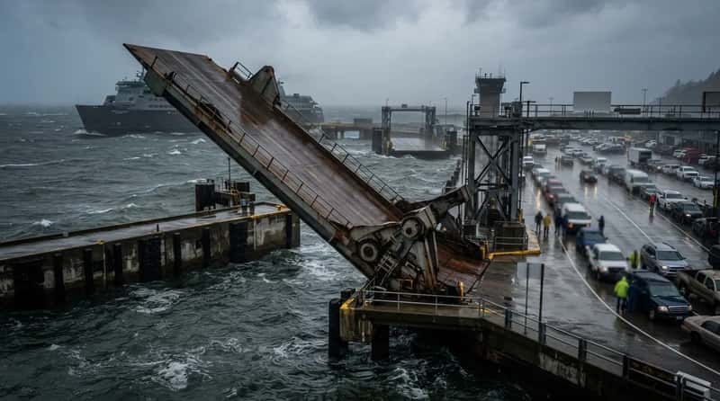
Here’s the part nobody thinks about until it’s too late: the loading ramps. High water and strong wind can prevent them from being safely raised or lowered onto the ferry.
It isn’t dramatic. It’s mechanical – the geometry just stops working.
Tidal surge pushes the water level up, the ramp angle turns extreme, and vehicles can no longer board. This single failure point can shut down an entire terminal before a single wave crashes over the dock.
Severe conditions can hit multiple berths at once, and operators don’t get to choose which ramp fails first. The terminal fills with stranded vehicles and passengers who did everything right and still aren’t going anywhere.
#8 – The Wind Numbers That Actually Decide Everything
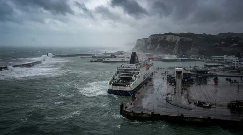
Forget the weather app. Ferry terminals run on hard, specific thresholds.
At major ports like Dover, once sustained wind inside the harbour passes 40 knots – strong gale, force 9 – vessel movement is off the table. Push past 55 knots from certain directions, violent storm force, and the port shuts down entirely.
Fast Facts
- 40 knots sustained: vessel movement stops at major ports like Dover
- 45 knots sustained: real risk of damage to fendering, vessels, and quaysides
- 55 knots from SSW-WSW: total port closure, violent storm force
- 25-30 knots: many smaller island routes cancel sailings well before this
Smaller routes go quiet even sooner. Once wind hits roughly 25 to 30 knots, many operators cancel sailings to smaller islands or exposed stretches of sea long before the big ports blink.
The gap between reduced service and total closure can be a matter of minutes, not hours. One strong gust pushes the average past the line, and the decision is made for everyone standing in that terminal.
#7 – The Terminal Fills Up With Nowhere to Go
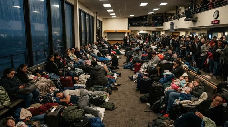
A cancelled sailing doesn’t empty a terminal – it fills one. A waiting hall built for a twenty-minute turnaround suddenly becomes an improvised shelter for the night.
If a ferry is docked mid-storm, crew may tell passengers to stay onboard in sheltered areas or move into the terminal building itself. These are spots chosen specifically to protect people from wind and flying debris.
Power can flicker, and card machines can go down without warning. Families crowd into corners with their luggage while truckers sit outside in idling cabs, waiting for news.
Most people never planned for this. They assumed the ferry would run, because it almost always does – until the one night it doesn’t.
#6 – Not Every Storm Attacks the Same Way
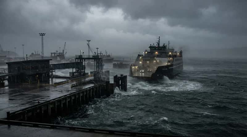
Extratropical cyclones, common in winter, bring strong wind, heavy rain, and choppy seas that build slowly and linger for days. They grind a terminal down rather than hit it all at once.
Local thunderstorms work differently – fast, vicious, and gone in an hour. Even a short squall near a terminal can drop visibility to nearly nothing and make docking dangerously risky.
At a Glance
- Extratropical cyclones: slow-building, multi-day wind and rain that wear a terminal down
- Local thunderstorms: fast, violent, and gone within the hour – but deadly for visibility
- Storm surge: the slow-moving flood risk that lingers long after the wind stops
Then there’s storm surge, the one that leaves a mark long after the sky clears. It floods terminals, wrecks infrastructure, and blocks access roads, pushing water into places that were never built to get wet.
Each storm type finds a different weak point in the same building. Some find all of them at once.
#5 – The Docks Are Quietly Taking a Beating
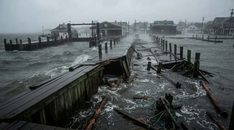
The infrastructure holding a terminal together is never as solid as it looks. Storms have flooded neighborhoods, downed trees, and wrecked floating docks nearby, cracking wooden bulkheads and leaving gaping holes behind.
At Shelter Island’s Greenport waterfront, the worst damage on record hit the stretch between the North Ferry landing terminal and Railroad Dock. That’s not some peripheral structure – that’s the heart of the whole operation.
A dock that took years to build can be rendered useless in under an hour. Repairs move slowly, and even when federal grants help, the waiting list is long.
The terminal you walk through on a calm Tuesday is quietly absorbing damage every single heavy season – and what comes next makes that impossible to ignore.
#4 – When the Water Climbs Over the Edge
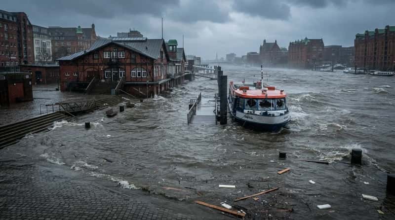
The moment storm surge overtops a terminal is unlike anything in normal operations. Hamburg’s port city saw water peak at roughly 6.5 feet above mean high water during one major winter storm, flooding the historic waterfront fish market and halting ferry service.
The River Elbe is normally placid, but conditions got bad enough that waves smashed through the windows at the bow of a river ferry. This wasn’t open ocean – this was a harbour.
Quick Compare
- Hamburg, winter storm surge: water rose roughly 6.5 feet above mean high water
- Bridgeport Ferry dock, Hurricane Irene: 1 to 3 feet of water pushed through the terminal
During Hurricane Irene, the Bridgeport Ferry dock took on 1 to 3 feet of water. That’s enough to sweep through ticketing areas, short-circuit electrical systems, and shove parked cars off course.
At that point, the terminal stops being a terminal and becomes a flood zone. The only question left is whether the building is even safe to stand inside.
#3 – The Ferry Caught Mid-Crossing
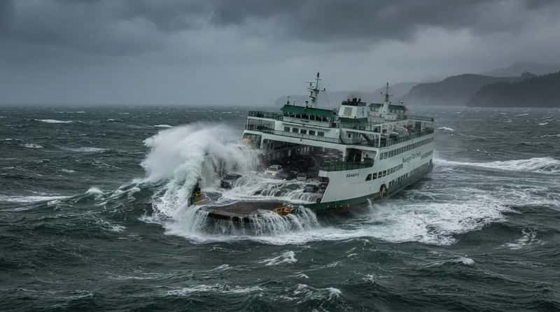
Sometimes the storm doesn’t wait for the boat to reach the dock. The Issaquah ferry flooded while crossing rough seas near the Strait of Juan de Fuca, footage showing it rocking hard as water gushed across the lower deck.
Photos from the passenger deck showed ceiling panels crashing down and the galley left in shambles. This wasn’t a hurricane – it was an ordinary Pacific Northwest winter storm.
We sometimes have waves crashing over the bow, but for this to happen, it is very, very rare.
Washington State Ferries
When that vessel finally limps back to the terminal, the dock crew faces a genuinely dangerous job. Crosswinds shove the ship off alignment, raising the risk of damage to both hull and pier in the same instant.
Docking in a gale is nothing like docking on a calm afternoon. One miscalculation, and the hull meets the piling.
#2 – The People Who Refuse to Leave
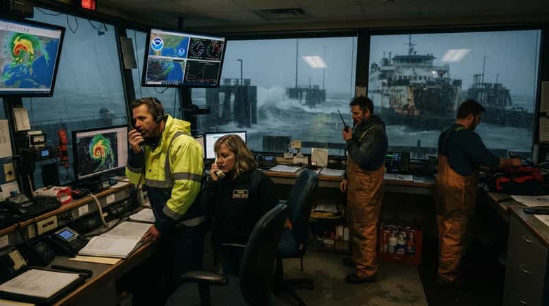
Through all of this, there are people who stay. Operators keep direct contact with meteorologists, watching the sky and the phone at the same time.
Coordination with the U.S. Coast Guard and local emergency agencies becomes constant, ensuring timely evacuations and a faster restart once the storm clears. Terminal staff manage stranded passengers and secure equipment while the building itself shakes around them.
During Superstorm Sandy, one ferry crew got a patient off an island to a hospital using nothing but a pickup truck and a tarp to shield her from the wind. That’s not a desk job in a storm – that’s a decision made in real time, with real stakes.
There’s one more thing a terminal faces after the wind finally dies, and it might be the most underestimated part of this whole story.
#1 – The Aftermath Nobody Warns You About
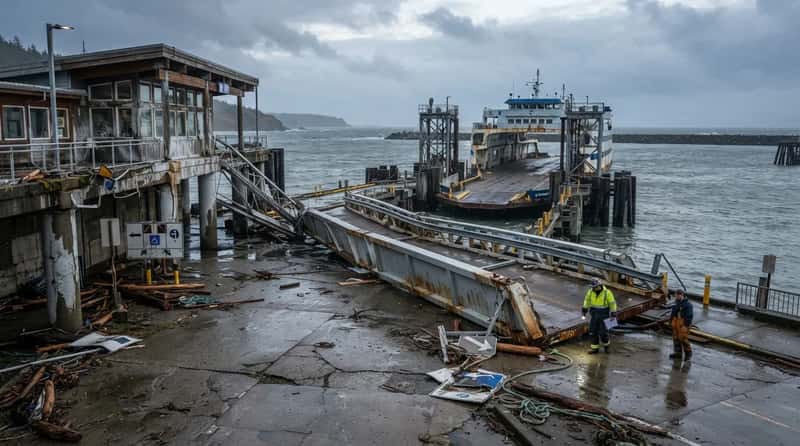
The storm passes, but the terminal doesn’t just reopen. Every vessel and every inch of infrastructure has to be inspected before a single sailing resumes, and that can take days.
Service comes back gradually, and the busiest route doesn’t automatically go first. The safest one does.
The structural toll adds up silently, storm after storm, season after season, leaving the infrastructure a little weaker each time. Buckled gangways, salt-coated electronics, cracked concrete, and crews who haven’t slept – that’s the honest picture.
What a ferry terminal looks like after a storm is, in many ways, more revealing than what it looks like during one. And somewhere in the world, that exact scene repeats itself every storm season without fail.
The Bottom Line
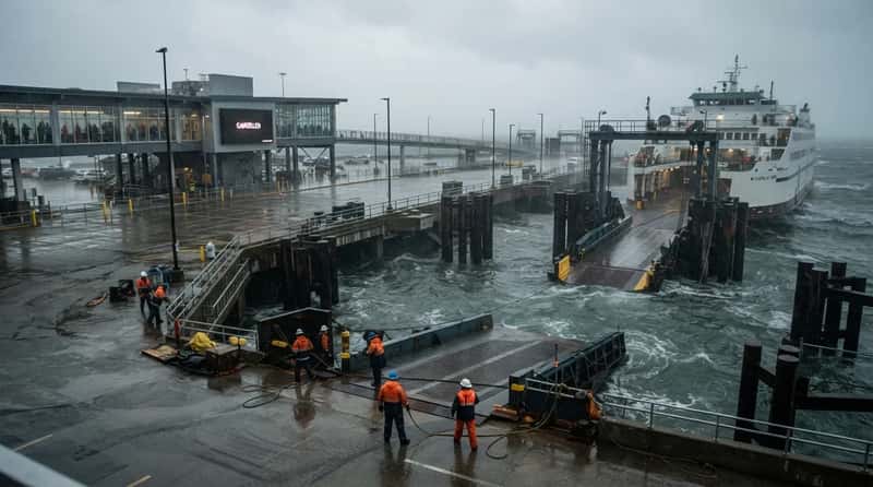
A ferry terminal in a storm is not a closed building with a sign on the door. It’s an active, pressured environment where wind thresholds decide sailings, ramp geometry decides boarding, and storm surge decides whether anyone should stay inside at all.
Real wind limits – as low as 40 knots for vessel movement at major ports – kick in long before conditions look catastrophic to the average passenger. The damage is real, it’s cumulative, and it’s expensive to undo.
The crews who hold it all together do so under conditions most people never see, and rarely think about, until the sign on the board says “cancelled.” Next time you glance at that word on your phone, you’re looking at the very end of a much longer story.
Bonus: The Trick That Beats the Cancellation Notice
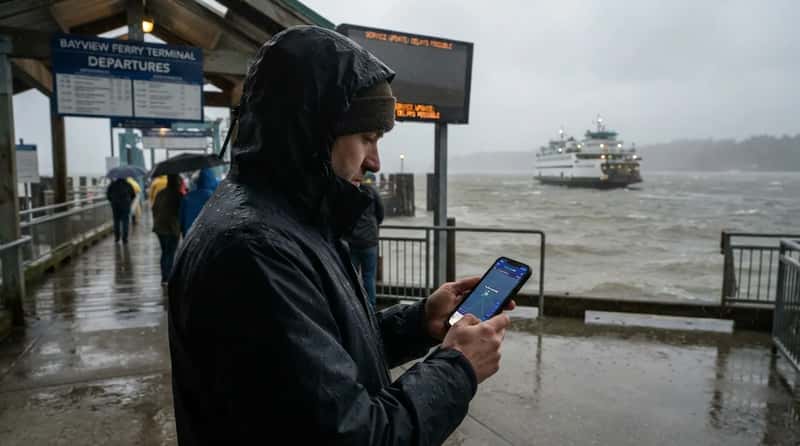
Official cancellation notices are often the last thing to update, not the first – operators wait to confirm before posting, which can cost you 20-30 minutes of decision time.
Savvy regulars skip the wait and check the vessel’s actual position instead, using a free live ship-tracking site or app such as MarineTraffic or VesselFinder.
- Search the ferry by name or route to see its live AIS position and speed
- If the boat has stopped moving, is holding at anchor, or reversed course, that’s your real-time signal – often before any official alert goes out
- Cross-check that against the marine forecast for your specific port, since thresholds differ by location (some smaller routes cancel at 25-30 knots, while major ports hold out until 40+)
- If the tracker shows normal transit speed and the forecast is under your port’s known threshold, you can usually head to the terminal with confidence
This single habit – watching the ship, not the website – is the closest thing to an insider’s early-warning system that any ordinary traveler can use for free.