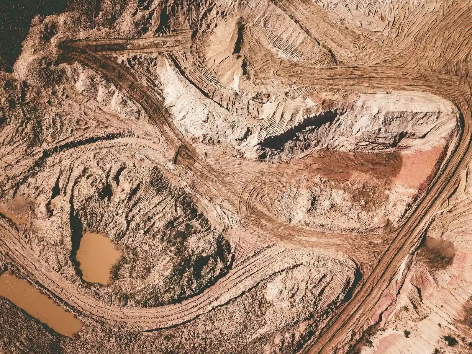
High above Chile’s Atacama Desert, the lithium extraction sites stretch across the salt flats in patterns that echo the layout of a computer circuit board. Photographer Tom Hegen has spent six years documenting major mining regions around the world through aerial photography, using small aircraft and drones to reveal landscapes altered by the demand for critical minerals. His images bring into view the environmental footprint of operations that supply materials for batteries in everyday devices and electric vehicles. The work stems from an earlier project on climate change in the Arctic that drew his attention to the minerals powering the energy transition. ([1])
Aerial Perspective on Extraction Sites
Hegen’s method relies on elevated viewpoints to capture the full extent of mining activity. From the air, the vivid lithium fields stand out against the desert terrain, their geometric patterns and channels visible in sharp detail. Ground-level observers often miss these broader transformations because the scale only becomes clear from above. The resulting photographs show how extraction reshapes entire regions in ways that remain hidden during typical travel or fieldwork.
Small aircraft and high-resolution cameras allow Hegen to document multiple sites across continents. Each image records the physical changes left by mineral removal, including altered waterways and expanded waste areas. This consistent approach over six years has produced a visual record of how modern technology depends on these remote operations.
Visible Changes Across Mining Landscapes
The photographs highlight several direct effects of extraction. Watercourses appear discolored in places where mercury has entered the system. Piles of mining waste have overtaken some settlements, shifting the local terrain. Along coastlines, sediment plumes extend into the sea and affect areas used by artisanal fishers. These elements appear together in the aerial views, showing connections between different parts of the landscape that ground observers rarely see at once.
Hegen has noted that an elevated perspective offers a powerful way to observe, understand, and reflect on how human activity has transformed the Earth’s landscapes. The images aim to prompt closer examination of these sites rather than present them as abstract or distant concerns. Demand for lithium, a key component in electric batteries, is projected to rise sharply as use of the metal expands.
From Arctic Observations to Desert Documentation
Hegen’s interest in critical minerals grew out of earlier work on climate impacts in the Arctic. That project illustrated the effects of changing energy systems and led him to examine the materials required for the transition. The shift in focus produced a sustained effort to photograph mining regions that supply those materials. Over the years, the aerial documentation has covered sites tied to both current technology needs and future energy goals.
The Atacama lithium fields serve as one prominent example in the larger body of work. Their circuit-board appearance from above underscores the link between everyday electronics and distant extraction zones. Similar patterns of landscape alteration appear in other regions Hegen has photographed, reinforcing the scale of the changes involved.
Why These Views Matter Now
The aerial record provides context for discussions about mineral supply and environmental consequences. Viewers encounter the images as evidence of ongoing activity rather than isolated events. Hegen’s approach keeps the focus on observable changes that accompany increased mineral production. The photographs continue to circulate as references for understanding the physical requirements of modern technology and the green energy shift.