There’s a strange logic to travel warnings. Tell someone a road is dangerous, narrow, or prone to landslides, and a fair number of them will start planning a trip there within the week. Across the world, a handful of routes have built reputations so fearsome that governments post warning signs, insurance companies refuse coverage, and locals shake their heads at foreigners who show up anyway. Yet these same roads pull in steady streams of cyclists, drivers, and photographers every single year, often more than the roads were ever designed to handle.
What makes these places different from an ordinary risky drive is the combination of genuine hazard and genuine beauty. A road can be dangerous and forgettable. These are dangerous and unforgettable, which is exactly why the warnings rarely work.
North Yungas Road, Bolivia
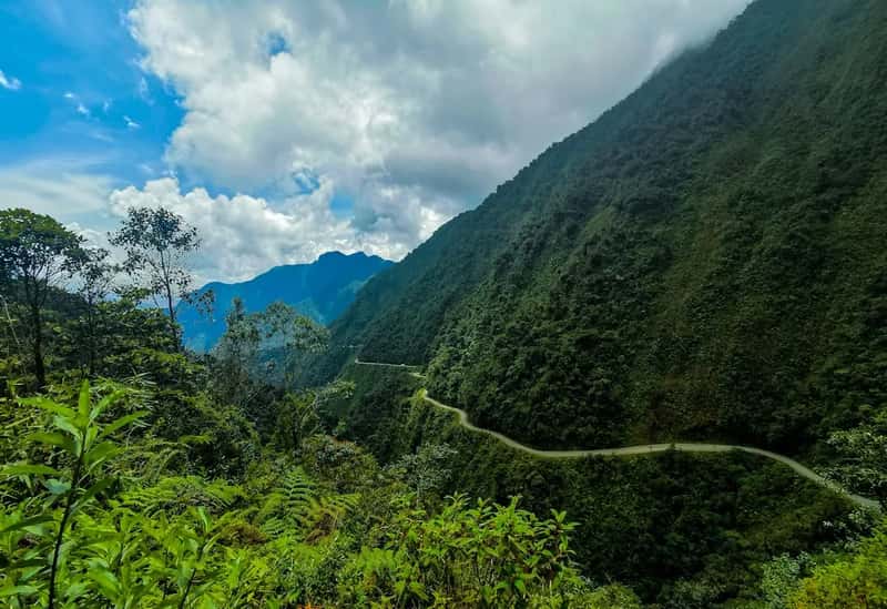
Known worldwide as the Death Road, this route was carved into the Andes in the 1930s to link La Paz with the Amazon lowlands, and much of the construction work was done by Paraguayan prisoners captured during the Chaco War. Known for its extreme descent of 3,500 metres, the road draws about 25,000 tourists per year and has become a popular destination for adventure tourism, particularly mountain biking. For decades it lived up to its name, with the Inter-American Development Bank formally labeling it the world’s most dangerous road in 1995.
A modern paved bypass opened in 2006, pulling most trucks and buses off the old cliffside track and leaving it largely to cyclists. With motor vehicles largely absent, the narrow dirt path became ideal for the mountain biking tourism industry that had started in 1998, allowing cyclists to descend without constantly watching for approaching trucks. The old road still drops from snowy highlands into steamy jungle in a matter of hours, which is precisely the sort of dramatic shift in scenery that keeps people booking the ride despite its history.
Stelvio Pass, Italy
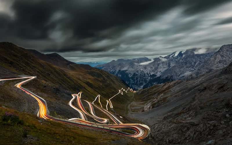
Tucked into the Ortler Alps near the Swiss border, Stelvio has become something of a pilgrimage site for drivers and cyclists chasing hairpin bends. At 2,757 metres above sea level, the Stelvio Pass is the highest paved mountain road in the Eastern Alps and the second highest in the entire Alpine range. The road was engineered between 1820 and 1825 by Carlo Donegani for the Austrian Empire, and its basic layout has barely changed since.
The northern ramp alone contains 48 numbered hairpin bends, stacked so tightly that from above they resemble a coiled spring. Snow and avalanche risk force the pass to close every winter, typically reopening in late May and shutting again by early November, and even in midsummer sudden snowfall near the summit is not unusual. It gained global fame after a 2008 Top Gear episode, and traffic has been thick with cars, motorcycles, and cyclists competing for space on the narrow tarmac ever since.
Guoliang Tunnel Road, China
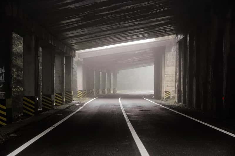
This is less a road than a hand carved miracle. Before 1972, the only way into Guoliang village in Henan province was a treacherous stone staircase cut into a cliff face, so thirteen villagers led by Shen Mingxin decided to blast and chisel their own route through the mountain instead. Working without machinery or official support and funding the effort by selling goats and wild herbs, they used 4,000 hammers, chisels, and 12 tons of steel to complete a 1,200 metre passage measuring 4 metres wide and 5 metres high, finished in 1977.
The tunnel is narrow enough that oncoming traffic has to negotiate carefully, and several open sections lack guardrails above sheer drops. Even so, tourism has boomed. In 2024, Guoliang Village received over one million tourists annually. A rockfall in early 2026 briefly closed part of the cliff face for inspection, a reminder that the mountain itself is still very much alive, though officials reported the incident caused no injuries.
Zoji La Pass, India
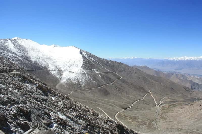
Connecting Kashmir to Ladakh, Zoji La has earned the nickname “Mountain Pass of Blizzards” for good reason. Sitting at an elevation of roughly 3,528 metres, it features steep gradients, rugged terrain, and extreme weather that frequently triggers avalanches, landslides, and heavy snowfall, rendering the route impassable for much of the winter. The road narrows to one lane in places, squeezed between towering walls of packed snow during the shoulder seasons.
Authorities have worked hard to shrink the closure window. The Border Roads Organisation undertakes intensive snow clearance, progressively shortening closure periods; the highway was closed for 110 days in 2021 but only 32 days in 2025. A long term fix, the Zojila Tunnel, is under construction but has slipped from its original target, with the project roughly 64 percent complete in early 2026 and the revised completion date pushed to February 2028. Until then, travelers keep timing their Ladakh trips around a pass that can close again with little notice.
Karakoram Highway, Pakistan and China
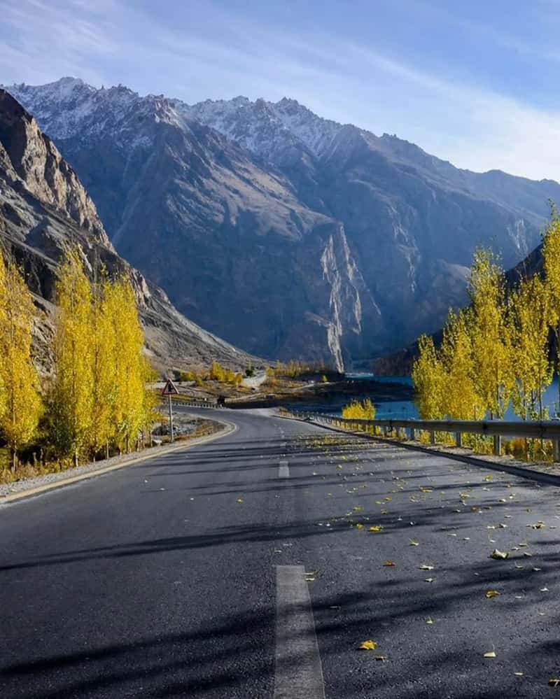
Often described as one of the highest paved international roads on earth, the Karakoram Highway threads through some of the most seismically active terrain in Asia, linking northern Pakistan to western China across the Khunjerab Pass. The scenery, glacial peaks, turquoise rivers, and villages perched on impossibly steep slopes, is part of what draws travelers who otherwise have no reason to be in this remote corner of the world. It has also become something of a bucket list ride for long distance cyclists and overland drivers chasing one of the more dramatic border crossings anywhere.
The tradeoff is near constant disruption from the terrain itself. Heavy monsoon rains have repeatedly triggered landslides along the highway, with debris flow severely blocking sections and stranding vehicles on both sides. Authorities regularly urge travelers to postpone trips during active weather, and winter snowfall causes its own separate round of closures, yet the highway remains a magnet for anyone drawn to genuinely remote high altitude driving.
Transfagarasan Highway, Romania
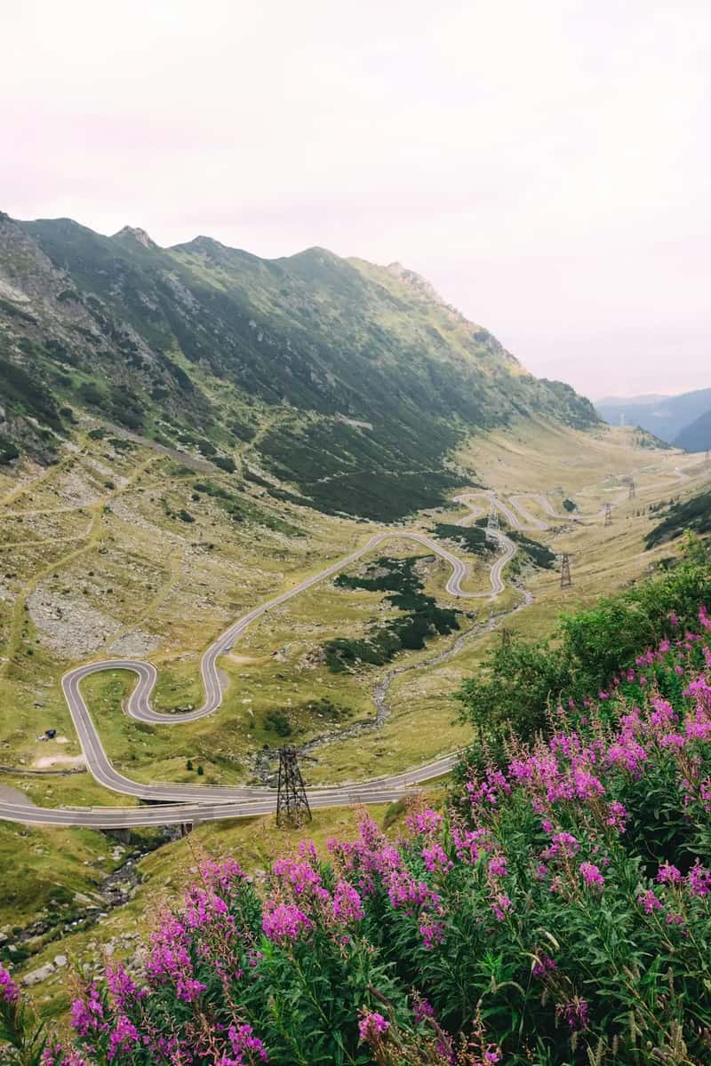
Built in the early 1970s as a strategic military route across the Făgăraș Mountains, the Transfagarasan climbs to more than 2,000 metres at Bâlea Lake through a dizzying series of switchbacks. It was commissioned under Nicolae Ceaușescu’s government partly to give Romanian forces a way over the mountains in case of a Soviet invasion, which gives the road an unusually political backstory for a scenic drive. Jeremy Clarkson’s enthusiastic praise for it on Top Gear turned the road into an international attraction almost overnight, and it has stayed on driving bucket lists ever since.
Snow closes the highest stretch for roughly half the year, usually from late October until sometime in June, and even in summer sudden storms can strand drivers near the tunnel at the top. The narrow lanes, unguarded drop offs, and heavy tourist traffic combine to make the busiest weekends genuinely nerve wracking. None of that seems to slow the crowds who arrive every summer chasing the same views that made the road famous in the first place.
Atlantic Ocean Road, Norway
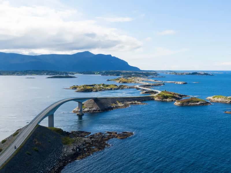
Strung across a scatter of skerries and small islands off Norway’s western coast, the Atlantic Road looks almost unreal in photographs, particularly the sweeping curve of the Storseisundet Bridge. Construction started in August 1983 and the area was hit by 12 European windstorms before the road finally opened on 7 July 1989. That history of brutal weather has never really gone away.
During storms, waves from the open Norwegian Sea can crash directly over the pavement, which sounds terrifying and is a large part of the road’s appeal. Frequently listed among the world’s best road trips, the curvy road dips and arches over the brutal waves of the Norwegian Sea that often crash over the pavement during storms. Car manufacturers have used it for commercials for years precisely because of that drama, and the route was voted Norway’s greatest engineering achievement of the century in 2005.
Skippers Canyon Road, New Zealand
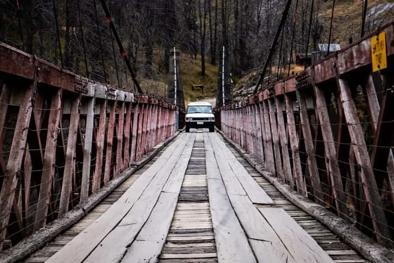
Carved out by gold miners in the 1800s near Queenstown, Skippers Canyon Road is a narrow gravel track clinging to the edge of a gorge, with barely enough width in some sections for a single vehicle. There are no guardrails along most of the route, and the drops down to the Shotover River below are sheer enough that most rental car companies specifically exclude the road from their insurance coverage. Locals treat it with a certain matter of fact respect, while visitors tend to arrive with a mix of nerves and excitement.
The reward for the drive is a landscape that feels almost untouched, jagged canyon walls, old mining relics, and river views that have made the area a popular backdrop for adventure tourism, including jet boating and bungee jumping nearby. Because passing oncoming traffic often requires reversing to a wider pullout, many visitors choose guided four wheel drive tours instead of self driving. Even so, the road keeps its cult following among travelers who want the kind of scenery that ordinary sightseeing routes simply cannot deliver.
Sichuan-Tibet Highway, China
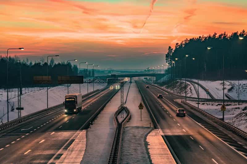
Officially known as the G318, this route crosses more than a dozen mountain passes above 4,000 metres as it winds from Chengdu toward the Tibetan plateau, making it one of the most physically demanding roads open to civilian travel anywhere in the world. Landslides and rockfalls are a near constant threat along certain stretches, particularly where the road hugs unstable slopes above the Yarlung Tsangpo and other major rivers. Sections have been rerouted through tunnels over the years specifically to bypass the most dangerous cliffside segments, including the notoriously accident prone stretch over Erlang Mountain.
None of that has dampened its popularity. Self drive road trips and long distance cycling along the G318 have become something of a rite of passage among younger Chinese travelers, who post their journeys across social media in huge numbers each summer. The altitude alone causes problems for unprepared drivers, yet the combination of glacier views, remote monasteries, and a genuine sense of accomplishment keeps the highway firmly on adventure travel lists.
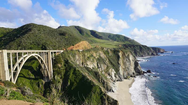
Pacific Coast Highway, Big Sur, USA
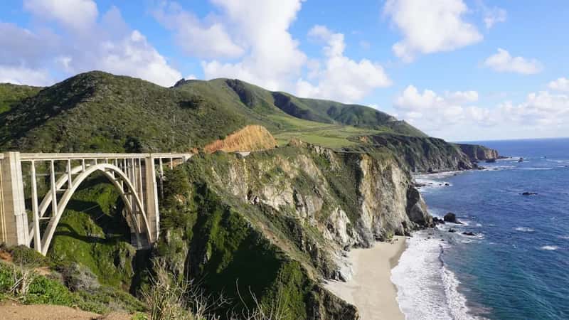
California’s Highway 1 through Big Sur is famous for cliffside views of the Pacific that rank among the most photographed coastal scenery in the country, but the same geology that makes it beautiful also makes it fragile. The road sits on unstable slopes prone to landslides, and closures due to slope failure or storm damage have become a semi regular feature of the route rather than a rare event. Entire sections have been rebuilt from scratch after major slides buried the roadway completely.
Despite the ongoing repairs and detours, the highway remains one of the most visited scenic drives in North America, drawing road trippers who plan entire vacations around it. Local tourism boards and Caltrans regularly post updates on which stretches are open, closed, or reduced to one lane, and seasoned travelers know to check conditions before committing to the drive. The appeal lies in a landscape where mountains drop almost straight into the ocean, a view that keeps pulling people back no matter how many times the road itself gets rearranged by the terrain beneath it.