I did not expect to fall this hard for a lake I could reach on a simple day trip. Yet Plansee has that effect. One minute you are driving through quiet Tirol valleys, the next you are staring at water so clear it looks unreal, backed by jagged peaks that feel almost too dramatic for their own good.
What surprised me most was that the best view is not from the shore. It is from a small, unofficial trail that climbs to a narrow ridge above the lake, where I thought to myself, I absolutely have to write about this..
No gondola. No crowds. No big signs screaming for attention. Just a “how is this not famous” kind of panorama.

I walked it recently, and I m still thinking about that moment when the trees opened up and the lake went full emerald beneath me. If you want a proper hidden gem in the Alps, this is it!!
Where is the Plansee
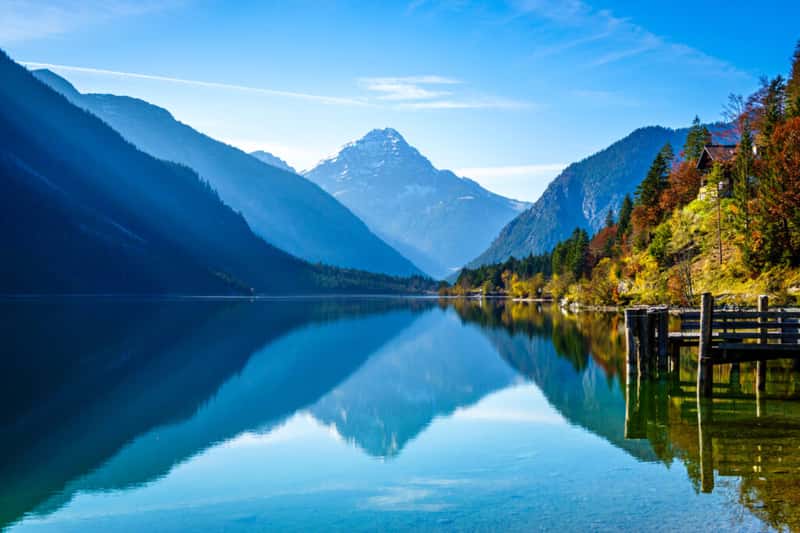
Plansee sits in the Reutte Nature Park region of Tyrol, close to the German-Austrian border and not far from towns like Reutte and Garmisch-Partenkirchen. It is Tirol’s second-largest natural lake, set at roughly one thousand meters above sea level.
The lake is long and narrow, stretching about five to six kilometers, and it drops to around seventy-six meters deep. The water quality is top tier, which helps explain that glassy, turquoise look and why divers love it here.
How to Get to Plansee
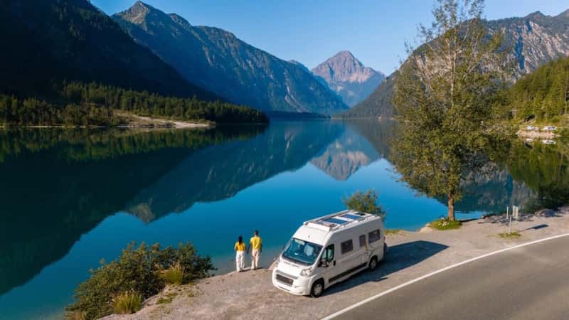
In my personal opinion, the easiest way to reach Plansee is by car. You drive to the hamlet called Am Plansee, right at the northern end of the lake, and park at the large lot near Camping Plansee and the Musteralpe area. Parking costs around five euros per day.
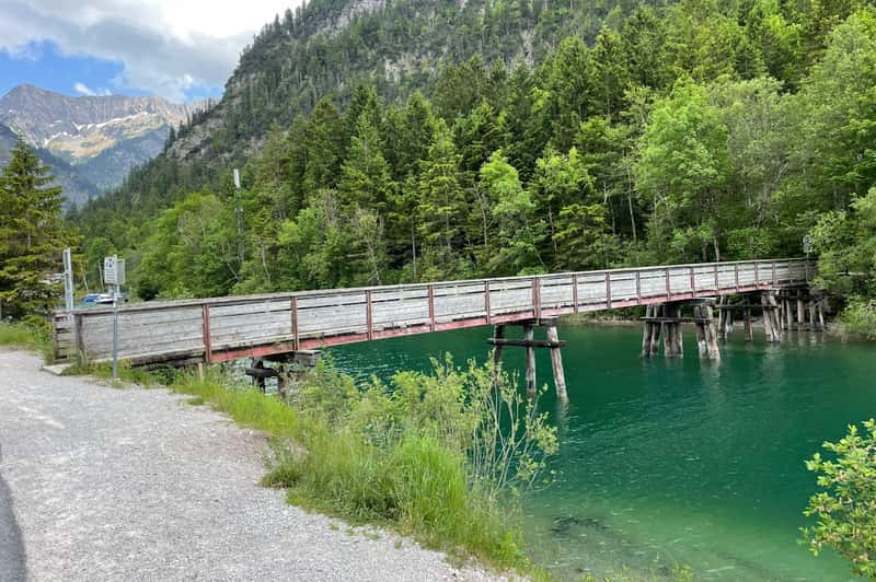
However, there are also bays along the way or at the side of the road where you can park for free. I would recommend that, as it’s not far to walk, you cross a bridge:
In summer, the parking, it fills up early, so arriving in the morning makes life easier. Public transport is possible from Munich or Garmisch via Reutte with a regional bus, but it takes much longer than driving (make sure you are well informed beforehand).
Find the Starting Point of the Hike
From the parking lot, I crossed the small bridge by the campsite and followed the lakeside path. This part is almost flat and very scenic. After roughly fifteen minutes, I reached a big dried riverbed full of light colored rock and rubble. This is the key landmark – see the following, rock slide, then go up to the right:
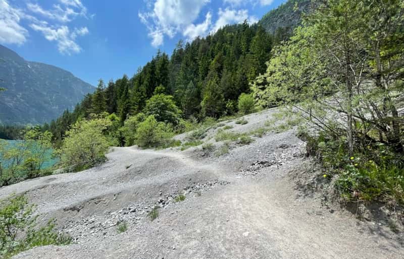
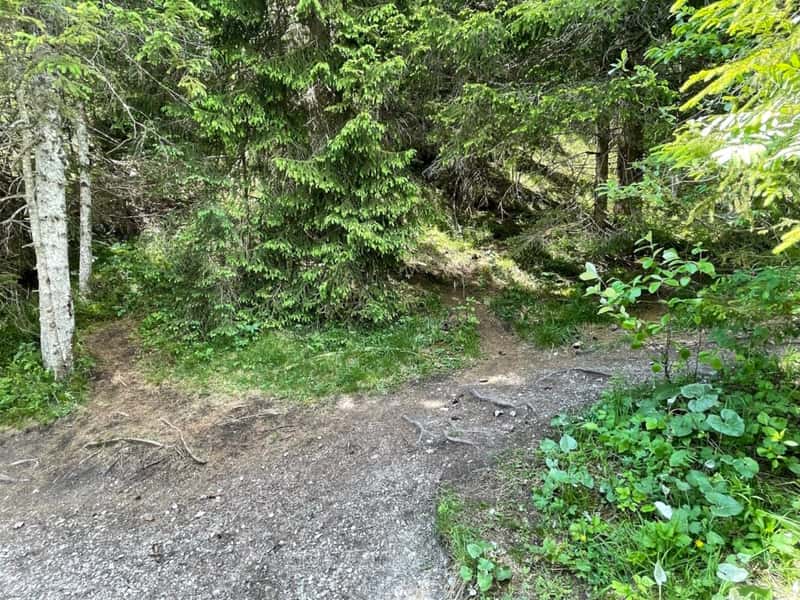
On the right side of that riverbed, a tiny path climbs into the grass. There are no official signs here, so you have to stay alert.
The GPS point for this turnoff is about:
https://www.google.com/maps?q=47.467139,10.792694
Once you spot the little track, you are on the right route – see following start of the hike:

Trail Overview and What It Feels Like
The climb starts immediately. The path is steep and narrow at first, with switchbacks that gain height fast. I remember feeling my legs wake up in the first few minutes. After about a quarter hour, I hit a junction and kept right, following the only clear trail that continues upward.
The slope eases a bit after that, then weaves through a forest section where the tread can get faint. I just kept aiming uphill, choosing the most worn line through the trees. It is one of those hikes where your instinct matters as much as your map. Here are impressions from the path:

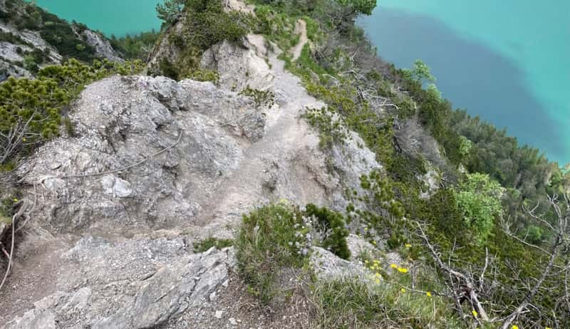
I reached the viewpoint after 30 minutes, but I walked up quickly. I think you should plan on 40-60 minutes for the climb.
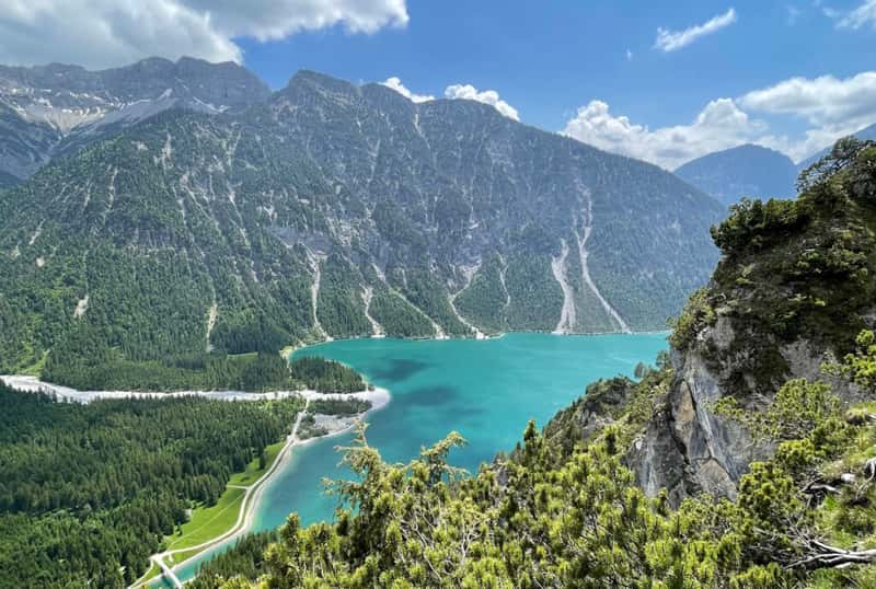
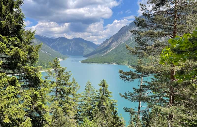
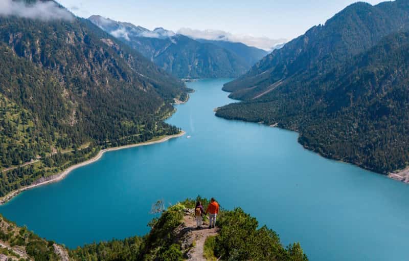
Three wooden loungers sit there now, making it easy to just collapse and stare. The view takes in Plansee’s full length and, on a clear day, you can also spot little Heiterwanger See to the south.
How difficult is the hike
I would rate this as a moderate hike (at least for me) with a punchy start. You need decent fitness because the ascent is steady and fairly steep early on. The good news is that there are no technical climbing moves, and the trail up to the viewpoint feels safe if you watch your footing. Kids who hike regularly and dogs used to mountain trails can manage it too.
| Overall difficulty | Moderate, with a steady uphill section |
| Time on trail | Upward walk: 30 min possible, normally 1 – 1.5 hours. Return downhill: ~ 1 hour |
| Total distance | Around 5 – 6 kilometers |
| Elevation range | Approximately 990 meters at the lowest point, up to about 1495 meters at the top |
| Total ascent | Close to 500 – 550 meters of elevation gain |
| Food and drink on route | No huts or refreshment stops along the hike, bring your own |
| Best season to go | All year round, but the trail is weather dependent |
| Good for kids and dogs | Yes, possible |
Safety, Ticks, and Ridge Etiquette
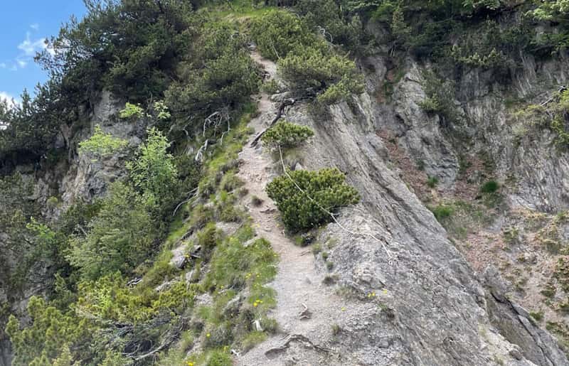
This is not an officially maintained route. That is part of the magic, but it also means you are responsible for your own safety (but you’re probably alone, which is amazing). Good hiking shoes are a must, especially if the ground is wet. In high summer, the lower section runs through tall grass, and locals report lots of ticks, so long pants and a tick check after the hike are smart.
One more thing. Past the viewpoint, the ridge narrows and drops steeply on one side. I stopped there, and the sources strongly suggest not continuing because the path is exposed and not clearly safe. Honestly, the viewpoint itself is the reward. You do not need to push farther (I did it, but you don’t have to if you don’t want to).
Best Time to Go and Weather Notes
The trail is typically most manageable from late March through October. Early spring can still hold deep snow higher up, and winter hiking here is possible but not recommended unless you have serious experience and the right gear.
I think shoulder season is perfect, fewer people and that crisp alpine air that makes every color sharper. I was there in June, and the fascinating thing was that I was alone on the entire trail; it really is a hidden gem.
Can you swim in Lake Plansee?
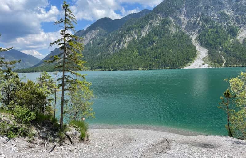
Yes, and you should if you are even slightly tempted. In summer, Plansee warms enough for swimming, with surface temps usually in the high teens to low twenties Celsius. The lake still feels refreshing because of its altitude, but on a hot day, it is pure joy. Paddleboarding is allowed, and there is even a designated dog beach next to the main parking area (also possible, Sailing, surfing, diving, or fishing).
- Summer sweet spot: Plansee usually reaches around 19 to 22 °C in July and August, making it ideal for a post hike swim.
- Spring is brisk: Expect water in the low teens Celsius, refreshing but short dip territory.
- Autumn cool down: By September the lake slips back toward the mid teens.
- Winter is icy: Water drops to single digits for most of late autumn and winter, better for quick plunges than real swimming.
How long does it take to walk around Lake Plansee?
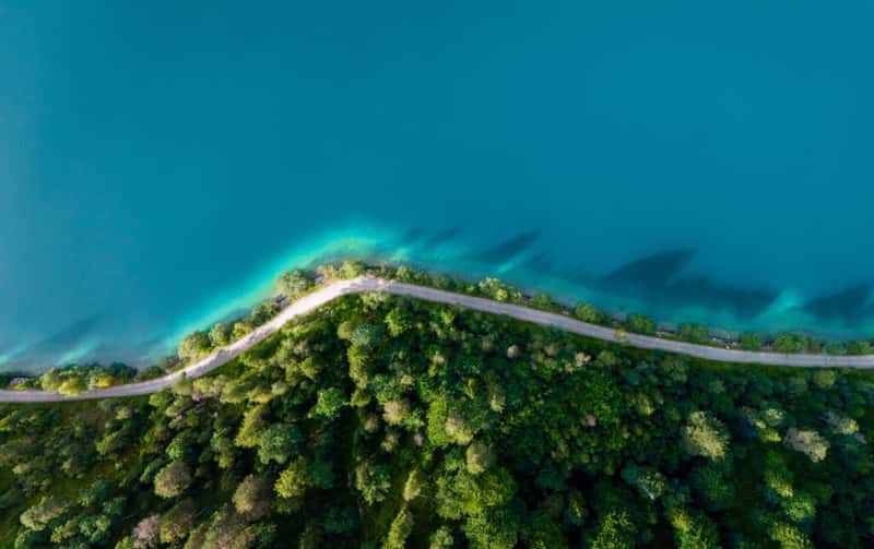
If you still have energy after the viewpoint, the lakeside loop is a beautiful extension. Walking the full circuit around Plansee takes about four hours at a relaxed pace. Parts of the shore have quite (if you’re quick, you can do it in 3 hours). little coves and pale sandbanks that feel almost Mediterranean, just colder.
What to Pack for This Hidden Hike
I kept it simple. Sturdy shoes, a light layer even on warm days, plenty of water, and snacks. There are no huts or refill points on the trail. A small sit pad or towel is nice at the top if the loungers are taken, and a power bank helps because you will take more photos than you expect.
Where to Eat Nearby
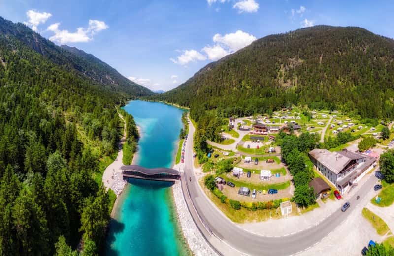
Back at Am Plansee, you have a couple of easy options. There is a small kiosk by the lake for quick food, and the Musteralpe nearby is a more satisfying stop with hearty alpine meals. It is the kind of place where a late lunch tastes twice as good because you earned it.
A Quick Reality Check and Why This Spot Feels Special

Plansee is already gorgeous from the water level. Still, the viewpoint changes the whole story. From above, you see the lake’s wild shape, the gradient of blues and greens, and the way the mountains cradle it like something precious. The hike is short enough to stay spontaneous, yet hidden enough to feel like you discovered it yourself. That balance is rare now. I think that is why this trail keeps haunting my brain in the best way.
If you go, take your time. Sit on that ridge. Let the silence do its thing. Then come back down and jump in the lake if it is summer. You will understand exactly why Plansee has quietly become one of my favorite alpine secrets.
What do you think about the viewpoint? Tell us in the comments.