
The Overseas Highway is a 113-mile run of US Route 1 that crosses 42 bridges on its way to Key West1, and the Leonida Keys in Grand Theft Auto VI borrow that shape. The catch is that Rockstar never names a single real place itself.
That matters if you plan to drive down with a list, because some matches below are well documented and others are fan guesses, and a wrong guess costs you gas and an afternoon. Only one of the twelve was logged from the first trailer by a newspaper, Miami New Times, and it waits at the very end.
The drive starts where the islands do, at Key Largo.
#12 – Key Largo, Where the Islands Begin
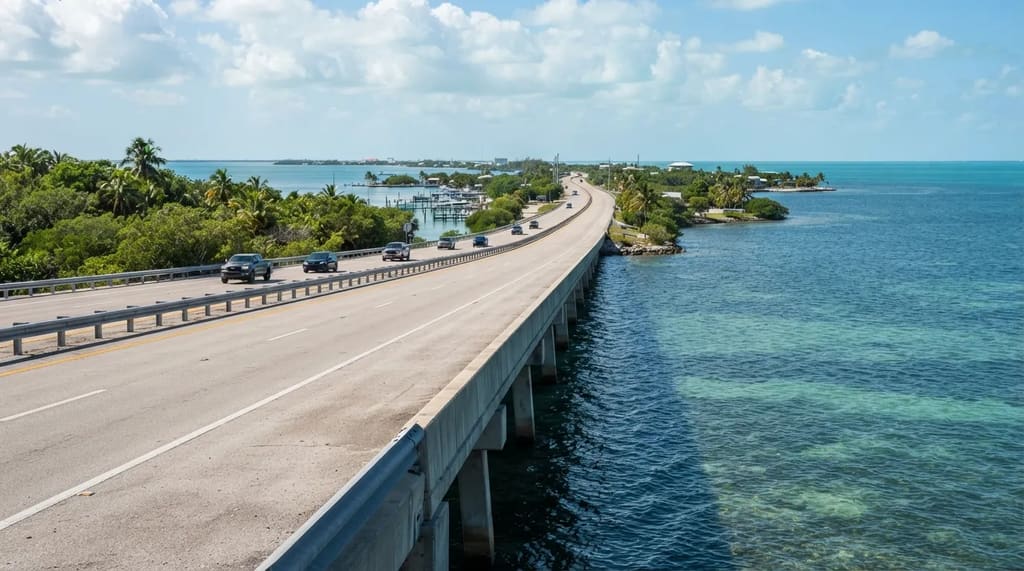
Key Largo is the first and largest island in the real Florida Keys, and comparison guides match it to the game’s Key Lento. Those same guides add that some of Key Lento’s roadside landmarks actually come from Islamorada, the next town south.
In the game, Key Lento is home to Jason’s stilt-house safehouse, Brian’s Marina, the Rusty Anchor bar and the Wonder Whale on Route 1. In real life those pieces are scattered across more than one town, so think of Key Lento as a blend of several places.
The drive from Miami to Key West is roughly 160 miles and takes about 3.5 to 4 hours without stops.1 With a dozen stops that estimate is useless, which makes Key Largo the place to start a two-day trip and not a town to rush through.
Key Largo bills itself as the diving capital of the world, but the game cares more about its docks and its dive bars. The first stop on the list is the boatyard Brian runs, which fans tie to a real marina on Blackwater Sound.
#11 – Marina Club at Blackwater Sound
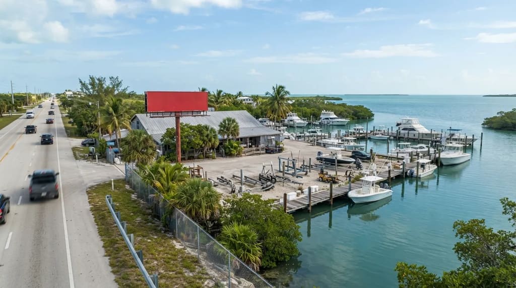
Brian Heder, one of the game’s main characters, runs a boatyard in the Keys, and fan mappers pair his marina with the Marina Club at Blackwater Sound in Key Largo based on a red sign visible above the trees. The real address is 103950 Overseas Highway, so it sits right on US-1.
A map site also lists a sign in the launch trailer at about the four-second mark. Like most matches on this list, it comes from fan mapping and not from Rockstar.
Fast Facts
- Real place: Marina Club at Blackwater Sound, Key Largo
- Address: 103950 Overseas Highway, right on US-1
- Game link: Brian’s boatyard and marina
- Source of the match: fan mapping, not confirmed by Rockstar
Jason lives in a stilt house owned by Brian, rent-free in exchange for helping with local shakedowns. That makes the marina part of the story’s home base, not background scenery.
A boatyard is a working business, so check its website or phone ahead before assuming you can walk the docks. If you only have a few hours in Key Largo, this is the stop to drop, because the next one is a bar you can actually sit down in.
#10 – The Caribbean Club Bar in Key Largo
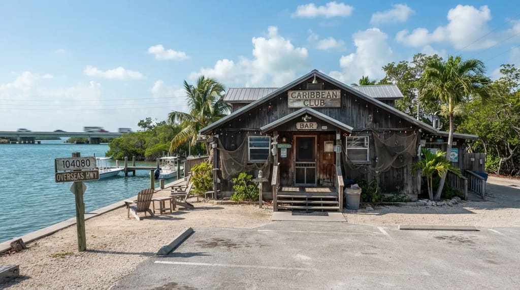
The Keys bar where Brian hangs out, the Rusty Anchor, is modeled on the Caribbean Club in Key Largo, which was also a filming location for the 1948 film Key Largo. It appears in Trailer 2 around the 1:20 and 1:30 marks, where the walls carry house-rule signs such as “No crying at the bar.”
The Caribbean Club’s address is 104080 Overseas Highway, in nearly the same address range as the marina. That means the two stops fit into one short detour.
Unlike the marina, a bar is meant to be entered, so this is the first stop where you can walk in and pull up a stool. A film that shares the island’s name, starring Humphrey Bogart and Lauren Bacall, gives it a reason to be on your list even if you never play the game.
Key Largo has no giant roadside lobster, so the game’s version of one had to come from a town farther south. To find the real thing, you have to keep driving into Islamorada.
#9 – Rain Barrel Village and Its Giant Lobster
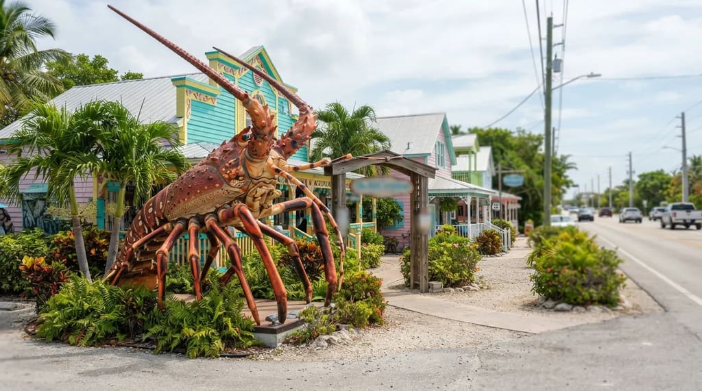
The game’s Wonder Whale is a parody of Betsy the Lobster, a giant sculpture in the Florida Keys, and of the Rain Barrel shopping village in Islamorada. Dexerto’s screenshot comparison describes a very similar location, with the statue replaced by a whale.
Betsy stands at Rain Barrel Village, 86700 Overseas Highway, where she was moved in 2009 and made into a roadside attraction.2 3 The village itself is a cluster of colorful buildings that house artists and art sellers.3
Travelers on the Overseas Highway can pass the shops without noticing, but the giant lobster out front is hard to miss. That makes it the best return for the least time on the list so far, since a photo and a quick look around cost a few minutes.
In the game the whale stands in Key Lento, a Key Largo stand-in, so Rockstar moved an Islamorada landmark up the road by a town. Rain Barrel is a stop for souvenirs and photographs, while the other Islamorada match on the list is an operating government station.
#8 – Islamorada’s Coast Guard Station on Palermo Drive
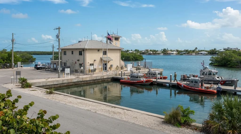
A landmark tracker matches the game’s Coast Guard station in the Leonida Keys to US Coast Guard Station Islamorada at 183 Palermo Drive. The match comes from fan mapping and is not something Rockstar has confirmed.
An active Coast Guard station is a place of work, not a sightseeing stop. What you can do is drive past on the public road and look, and Islamorada bills itself as the sportfishing capital of the world, so the working boats nearby are part of the view.
Because it is in the same town as Betsy the lobster, you can cover both in one outing. Rockstar folded real stretches like Key Largo and Islamorada into invented in-game places instead of copying them one for one, which explains how a station from Islamorada can turn up elsewhere on the game’s map.
Do not build a day around this one, since it earns its place only because it costs nothing extra once you are in Islamorada for the lobster. The next match is even easier, because all you have to do is look up.
#7 – The Radar Blimp Over Cudjoe Key
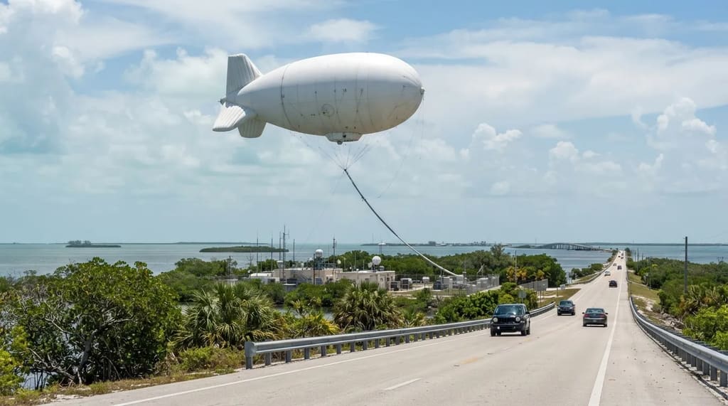
The game’s radar blimp matches Fat Albert on Cudjoe Key.4 Cudjoe Key belongs to the Lower Keys, the quieter islands that also hold the National Key Deer Refuge.
Fat Albert is a tethered radar balloon, so it is the one stop here that needs no stopping. Look up from US-1 as you drive, and the balloon is large and high enough to see from a distance when it is flying.
Compare that with the Coast Guard station, which you also see only from outside. The balloon at least shows itself from the road, so you do not have to hunt for a pull-off to find it.
Quick Compare
- Fat Albert, Cudjoe Key: look up from US-1 when it is flying
- Coast Guard Station Islamorada: a view from the public road only
- Naval Air Station Key West: controlled access, road view at most
- Rain Barrel Village: park, walk around and take photos
By now the road has slowed from the busy upper Keys, so this is a smart place to check the clock and the fuel gauge. Past the blimp, the highway runs toward Key West and the real base behind the game’s naval air station.
#6 – Naval Air Station Key West
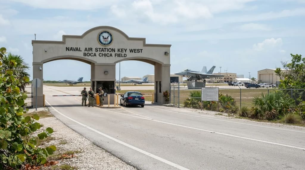
The game’s naval air station maps to Naval Air Station Key West, which sits on Boca Chica Key just before Key West itself. A landmark map plots several points on and around the base, including addresses on Shrimp Road.
This is a working military installation, so access is controlled and a visitor should expect to see it from the road at most. Obey posted signs, and do not photograph from anywhere they forbid it.
Do not turn this one into a destination. Of everything on the list it gives a visitor the least to do, and the time you save goes to places where you are welcome.
The next stop is the opposite, a place where you are not only allowed in but expected to sit down and order. It is also one of the few matches on the list where a real meal is the whole point.
#5 – Blue Heaven on Thomas Street
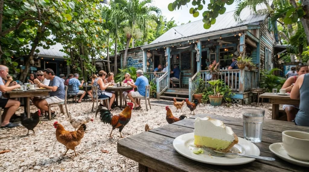
In the game it is the Blue Crab Bar & Grill, and fans match it to Blue Heaven in Key West. A landmark map lists the real address as 729 Thomas Street.
Unlike the military and Coast Guard entries, this is a restaurant, so you go as a customer and the visit is built around a meal. Blue Heaven is known for its roaming chickens and its tall meringue key lime pie.
It is also the easiest stop here for a reader who does not care about the game, since a meal in Key West needs no special reason. Plan it around lunch or dinner and not around a photo.
Key West sits at the end of US-1, so it is a natural place to rest before the long drive back. Blue Heaven is a single address on Thomas Street, while the bar atmosphere the game leans on spreads across an entire street.
#4 – Duval Street and Mallory Square
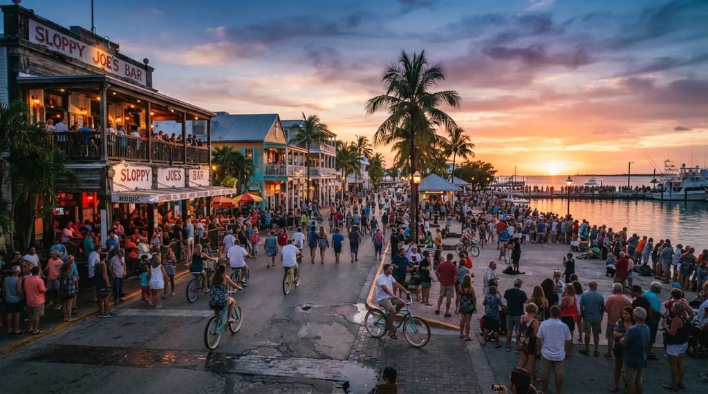
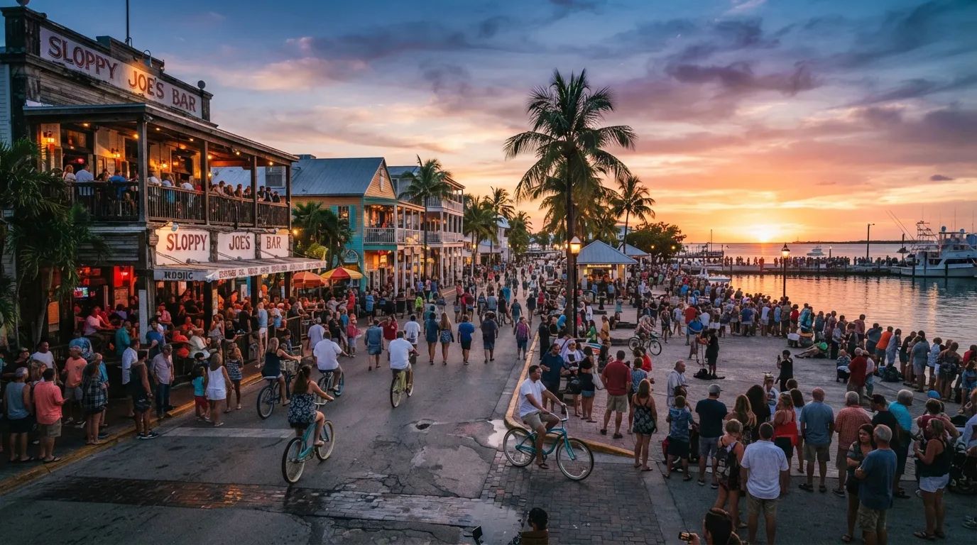
Travel writers point to Duval Street and Mallory Square in Key West, with historic blocks of open-air bars, conch-style wooden houses and nightly sunset crowds along the harbor. They offer it as the nearest real thing to the game’s bar-heavy Keys.
The link here is atmosphere. The game’s casual paradise tone lines up with Duval Street’s bar culture, but no specific game building is tied to these blocks.
The real Key West moves at a much slower pace than the game’s high-speed island chaos, and a rented beach cruiser is the easiest way to get around town. Compared with Blue Heaven, which is one address with a menu, this is a whole district.
Give it an evening and let the sunset set your schedule. Then head back up the chain, because the last three stops on this list are all bridges.
#3 – Old Bahia Honda Bridge and Its Missing Section
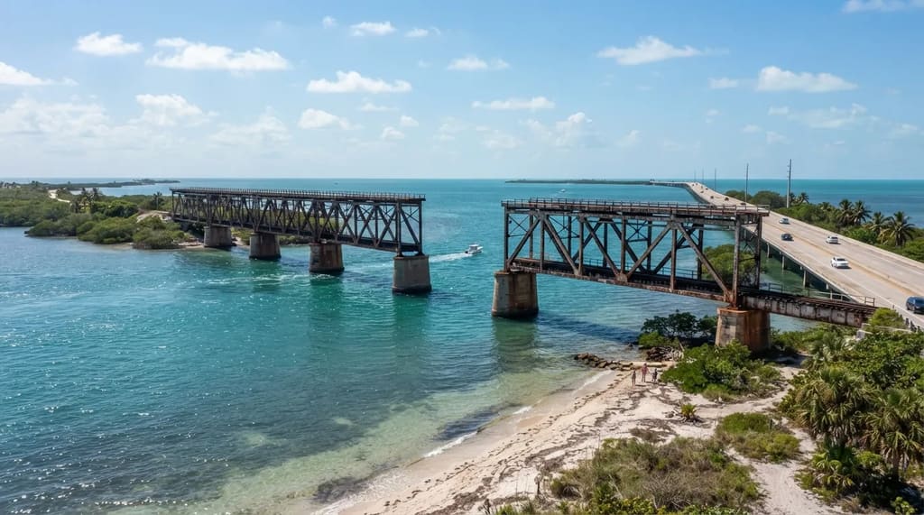
Two bridges in the game’s Keys are based on the Bahia Honda Rail Bridge, an old abandoned railroad bridge and one of the most photographed spots in the real Keys, and the newer road bridge that replaced it. A landmark tracker lists the match as the Old Bahia Honda Bridge.
Some fans saw the trailer’s aerial shot and thought of the Rickenbacker Causeway instead. Yet the missing section in the game’s old railway bridge closely resembles the real gap, which was removed to stop pedestrians and allow more boat traffic.5
The bridge connects Bahia Honda Key with Spanish Harbor Key, and the best views of the bridge and open water come from nearby Bahia Honda State Park. Part of the old bridge is accessible from the park, with a panoramic view of the islands.5 6
Related Stories From Travelbinger
Worth Knowing
- Bahia Honda State Park covers 524 acres6
- The gap in the old rail bridge is real, and it was cut on purpose
- The old rail bridge and the newer road bridge stand side by side
- Best vantage point: the park, not the highway shoulder
This is the first stop on the list worth real time, because a park with a view and a bridge you can stand on beats a roadside sign. Another former railway bridge, farther up the chain, has been turned into a path you can walk.
#2 – The Old Seven Mile Bridge, Open to Walkers
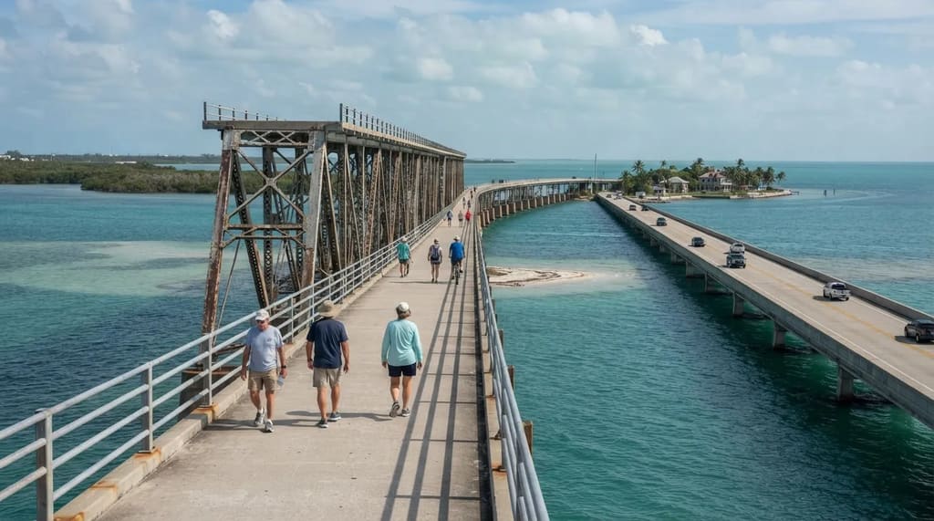
The older Seven Mile Bridge was built from 1909 to 1912 as part of the Overseas Railway, and it later carried cars until the newer bridge opened in 1982. A restored stretch of it next to the current bridge is now open to walkers and cyclists.7
Fan sources describe the game’s Keys as having a broken span echoing the old Seven Mile Bridge, while the tracker credits Bahia Honda’s gap for the same image. The game’s broken bridge may borrow from both, and sources differ on which.
The section that reaches Pigeon Key is 2.2 miles long, so a round trip on foot is more than four miles.7 Florida sun can make that long, so turn around whenever the heat or the clock says to, because you do not need to finish it to get the view.
Running beside the old span is the newer one that carries all the traffic, and that is the bridge in the trailer. It is also the one match on this list that nobody argues about.
#1 – Seven Mile Bridge, Knight’s Key to Little Duck Key
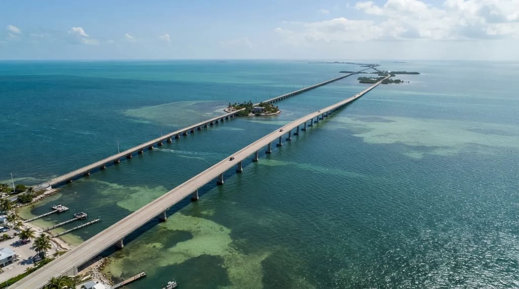
In the first trailer, the Seven Mile Bridge, one of the longest bridges in the country, gets its own aerial flyover. Miami New Times counted 20 real landmarks in that trailer, from Ocean Drive down to the Seven Mile Bridge.8
The bridge links Knight’s Key at Marathon to Little Duck Key, where the Overseas Highway reaches its west end at approximately mile marker 40. Few other stretches of US-1 put you so far out over open water.
Why It Stands Out
- Documented by a newspaper, not just fan maps
- Given its own aerial flyover in the first trailer
- Named separately by travel writers, map sites and Miami guides
- Open to anyone with a car: no gate, no reservation
Travel writers, fan map sites and Miami guides all name it separately. One travel site describes the water around it as shallow and turquoise, and a Miami guide says the game’s Keys include a version of the Seven Mile Bridge.
That is why it comes last. It is the one match documented by a newspaper, repeated by independent guides, and open to anyone with a car and no gate or reservation.
Give Each Stretch of the Highway Its Own Hour
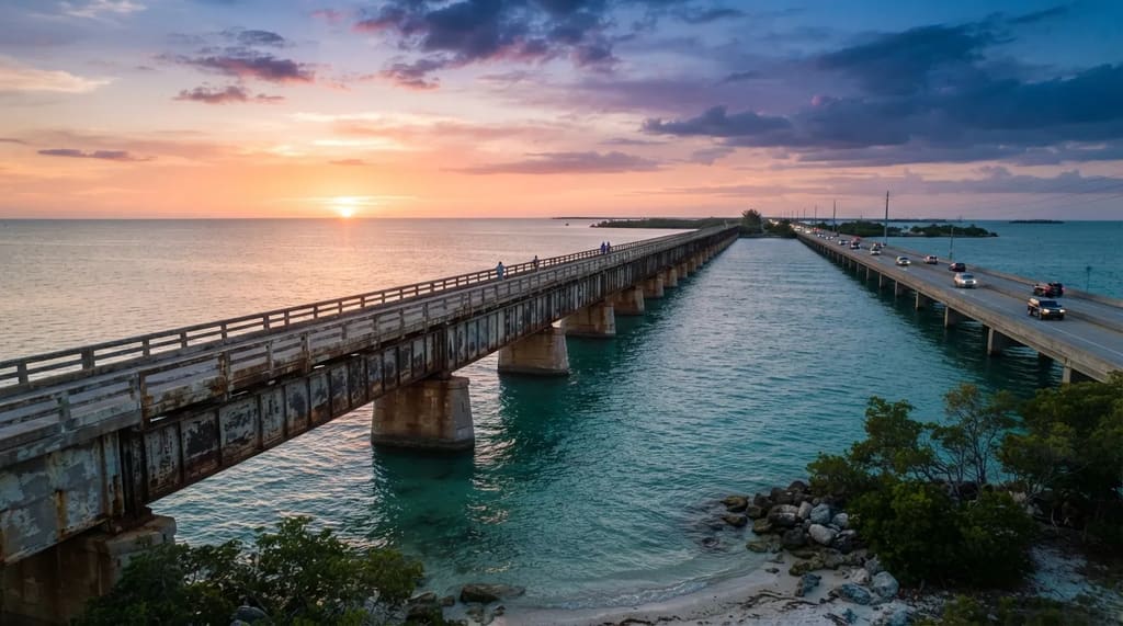
The twelve stops fall into a few stretches of road, and the game folds them into one town while the real places are miles apart. Treat the drive as several short visits that happen to share a highway, with a bar in Key Largo, a lobster in Islamorada and a balloon over Cudjoe Key.
Pick the stretch that suits you, whether that is the walk at Bahia Honda or the old bridge at sunset, and give it an unhurried hour. A list of twelve stops is easier to enjoy when you let most of them be a glance from the car.
Rockstar built a fantasy, but the road under it is real and open to anyone with a full tank. Which stretch of the Overseas Highway have you driven, and where did you stop longer than you planned?
- Overseas Highway Guide: https://govisitflorida.com/blog/driving-to-key-west/
- Betsy the Lobster: https://www.atlasobscura.com/places/betsy-the-lobster
- Rain Barrel Village AP Feature: https://www.wlrn.org/arts-culture/2025-05-06/rain-barrel-village-old-florida-giant-lobster
- Cudjoe Key Fat Albert: https://en.wikipedia.org/wiki/Cudjoe_Key
- Bahia Honda Rail Bridge: https://en.wikipedia.org/wiki/Bahia_Honda_Rail_Bridge
- Florida State Parks Bahia Honda: https://www.floridastateparks.org/sites/default/files/media/file/Bahia-Honda-0119.pdf
- Visit Florida Keys Seven Mile: https://visitfloridakeys.com/plan-your-trip/plan-book/getting-here-around/seven-mile-bridge
- Miami New Times Landmark Count: https://gta6-life.com/en/guides/gta-6-real-life-locations/