
A field west of Amarillo holds ten Cadillacs buried nose-first in the dirt, and that is one of the tamer stops on this list. Texas also has a Prada store in the desert that never opens, a bridge in the capital where bats pour out at dusk, and a Panhandle canyon that locals call the Grand Canyon of Texas.
But this state is big enough that one badly chosen stop can eat half your day. The countdown starts with quick roadside photos and ends at places where the drive is part of the price. The final stop sits right beside one of America’s best-known national parks, and it sees only a sliver of the crowds.
#13 – Ten Cadillacs Nose-Down in an Amarillo Wheat Field
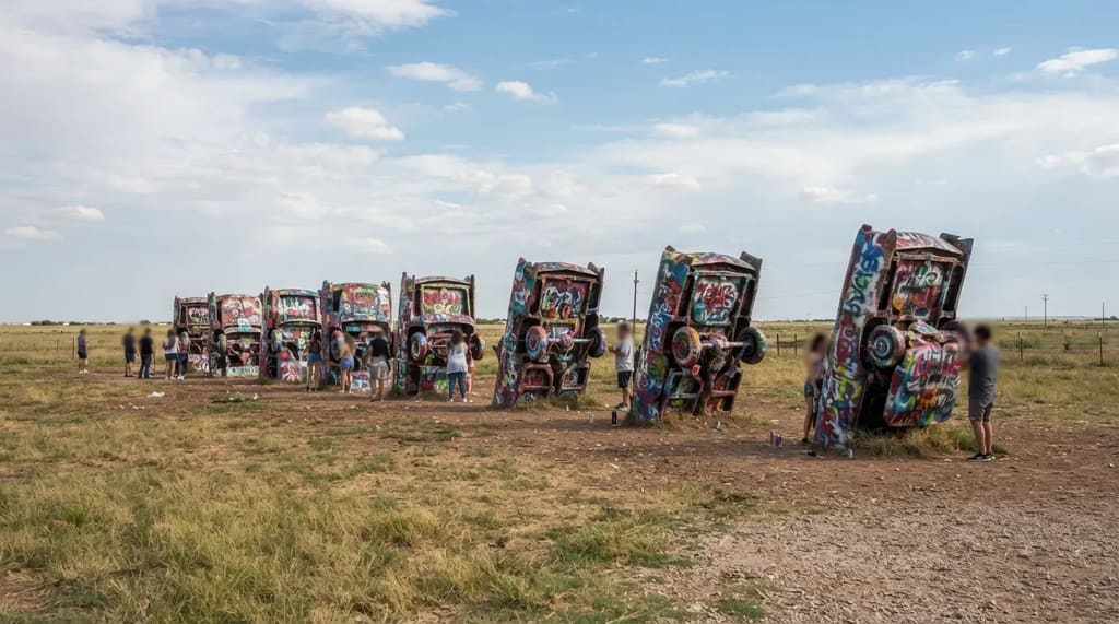
Along the old Route 66 corridor west of Amarillo, ten Cadillacs stand with their noses in the ground and their tail fins in the air. The art group Ant Farm planted them in 1974, using models from the late 1940s into the early 1960s. Read left to right, the row is a lineup of changing tail-fin styles. The cars were later moved about two miles west to a new pasture, where they have stood ever since.
The art invites the paint. Visitors spray the cars themselves, so the layers keep piling up, and whatever you photograph is buried under new color within days. The whole stop takes about twenty minutes, which makes it a perfect break in the drive and not a reason to plan a day around.
#12 – A Locked Prada Store Out on US 90
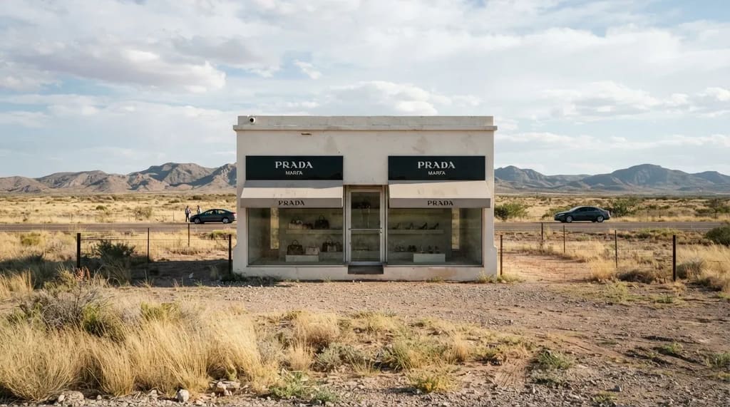
Beside US 90 near the tiny town of Valentine stands a small building with a Prada sign and two windows full of handbags and shoes. The door never opens. It was installed about 26 miles northwest of Marfa and inaugurated on October 1, 2005, so the name misleads: the building is not in Marfa at all.1 The bags and shoes are real pieces from Prada’s fall and winter 2005 collection.
The artists meant it as a joke on the luxury goods industry, a boutique dropped into the middle of nowhere. They expected it to wear away slowly, but burglars broke in and stole bags and shoes within days of the opening. Today it is a ten-minute stop, and it earns that time if you are already on US 90 heading toward Marfa or Big Bend.
#11 – Longhorns on Parade Down Fort Worth’s Exchange Avenue
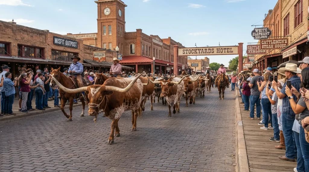
Fort Worth keeps its cowboy past alive in the Stockyards, where a small herd of Texas longhorns is walked down Exchange Avenue twice a day. The animals steal the show. Their horns can spread wider than a grown man’s outstretched arms, and watching them clop past a row of tourists feels like a scene from another century.
The drive recalls the era when cattle moved north along trail routes, and the city earned the nickname Cowtown by sitting on those routes. The show lasts only a few minutes, so check the posted times and claim a spot along the curb early. Saloons, old exchange buildings and the rodeo arena are all within walking distance, and a weekday visit means thinner crowds on the sidewalks.
Fast Facts
- The herd walks twice a day, usually late morning and late afternoon.
- Watching from the sidewalk is free.
- The walk itself is brief, so build in time for the Stockyards around it.
- Times can shift with weather and events, so confirm before you park.
#10 – The Alamo Church Is Smaller Than Its Fame
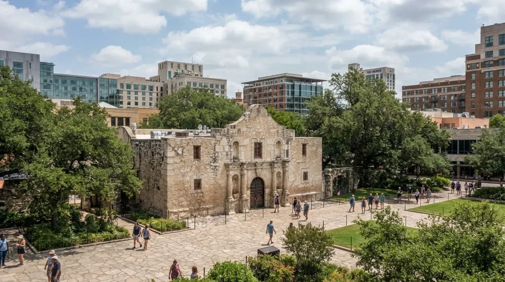
In downtown San Antonio, the Alamo’s old stone chapel sits in a plaza ringed by modern buildings. Visitors who expect a sprawling fort are often startled by how compact it is. The defenders’ last stand in 1836 became a rallying cry in the Texas fight for independence from Mexico, which explains why such a small footprint carries so much weight.
The Alamo is part of the UNESCO World Heritage listing for the San Antonio Missions, a group of five mission complexes. The other four lie south of downtown along the river, and the National Park Service runs them as San Antonio Missions National Historical Park. Start with the Alamo for the history, then give the missions an extra hour. They are open-air and have far more room to wander.
#9 – Houston’s Space Center Where Apollo Flights Were Run

Space Center Houston is the visitor center for NASA’s Johnson Space Center, the home of Mission Control. The tram tour usually reaches Rocket Park and the historic Mission Control room, though tours change, so check what is running the day you go. Standing in that room is the whole point. “Houston” was the word Apollo crews used when they called the ground.
Plan on about half a day, which makes this the longest stop so far. It is also the one place on the list where an indoor visit makes sense in July, when a Houston afternoon feels like walking through warm soup. If your road trip hits a heat wave, this is your escape.
At a Glance
- Best for: Scorching afternoons and space-minded kids and adults.
- Time needed: About half a day.
- Don’t miss: The historic Mission Control room and Rocket Park.
- Before you go: Check which tram tours are running that day.
#8 – A Billion-Year-Old Granite Dome That Groans
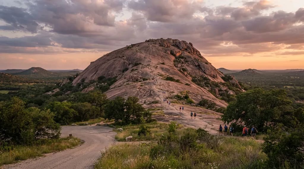
Enchanted Rock rises from the Hill Country north of Fredericksburg as a huge dome of pink granite, roughly 425 feet above its base. The rock is well over a billion years old, which makes the cars at Cadillac Ranch look like recent arrivals. The Summit Trail up the bare stone is well under a mile each way, but it is steep, and the view from the top sweeps across the Hill Country.
The rock also has a reputation for noise. Visitors have long reported creaks and groans after sundown, and Native American stories connect the place to spirits. The park often fills on weekends and closes its gates at capacity, so reserve a day-use spot through Texas Parks and Wildlife before you drive out.
#7 – Bats Pouring Out From Under an Austin Bridge
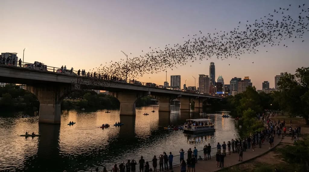
Under the Ann W. Richards Congress Avenue Bridge in downtown Austin, a colony of Mexican free-tailed bats rises each evening in warm weather. It is often described as the largest urban bat colony in North America.2 And nobody planned it. Engineers rebuilt the bridge in 1980 and added narrow expansion joints under the deck, and the bats simply moved in.
Austin once wanted them gone, but education efforts turned public opinion around, and the colony became a major attraction.2 Viewing is free, and the season runs from March through October, with the strongest shows from late July through mid-September. Arrive 30 to 45 minutes before sunset, and expect cool or rainy evenings to delay or shrink the flight.
#6 – A Cypress Swamp Draped in Spanish Moss
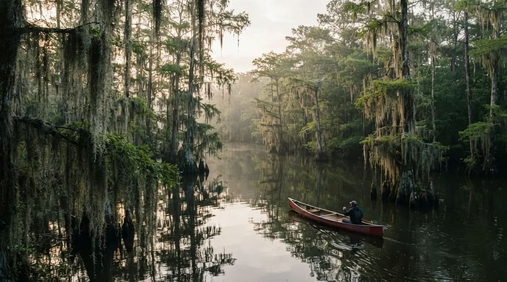
Caddo Lake sits on the Texas and Louisiana line in the Piney Woods of East Texas. Bald cypress trees rise straight out of dark water, with Spanish moss hanging from the branches like curtains. It is one of the few large natural lakes in a state where most big lakes are man-made reservoirs. The maze of bayous and sloughs is better explored by paddle than by motor.
The channels branch so often that a first-time visitor can lose their bearings, so stick to marked boat roads or hire a local guide. Paddle early in the morning, when the water is calm and the light filters through the moss. Summers are humid and buggy, so pack repellent and plenty of water.
Worth Knowing
- Caddo Lake is recognized as a wetland of international importance under the Ramsar Convention.
- Spanish moss is not a true moss. It is a flowering plant in the pineapple family.
- A small East Texas town near the lake is named Uncertain, which suits the maze of channels.
- Marked boat roads are your safety net when every bayou starts to look the same.
#5 – Seventy Miles of Beach With No Condos
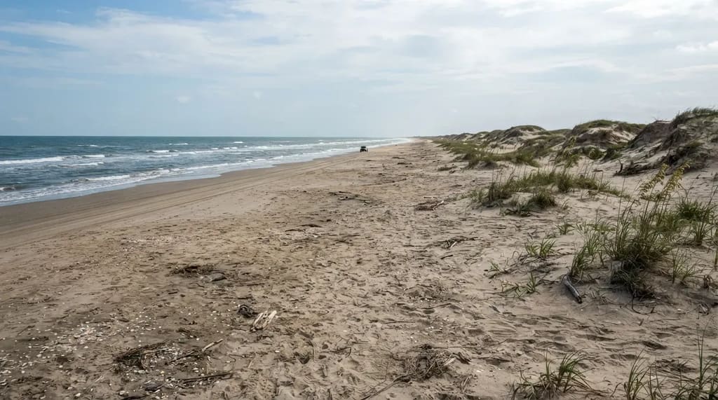
South of Corpus Christi, Padre Island National Seashore protects about 70 miles of the Texas coast, and the National Park Service calls it the longest undeveloped stretch of barrier island in the world.3 There are no high-rise hotels along the shore, only dunes, shells and wide-open sand. It looks nothing like most beach towns on the Gulf.
Beyond the paved stretch, driving on the sand generally calls for four-wheel drive, and soft sand can strand a car, so check the park’s current conditions first. Bring your own water, since facilities thin out once you leave the visitor center. The farther you walk from the parking lot, the emptier the beach gets.
#4 – Palo Duro Canyon Drops Away Beneath the Plains
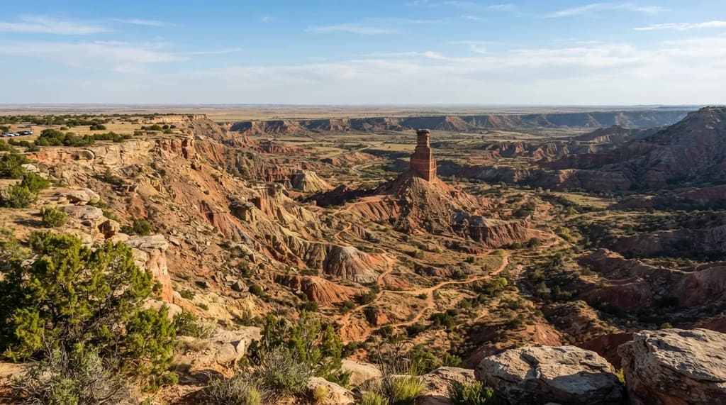
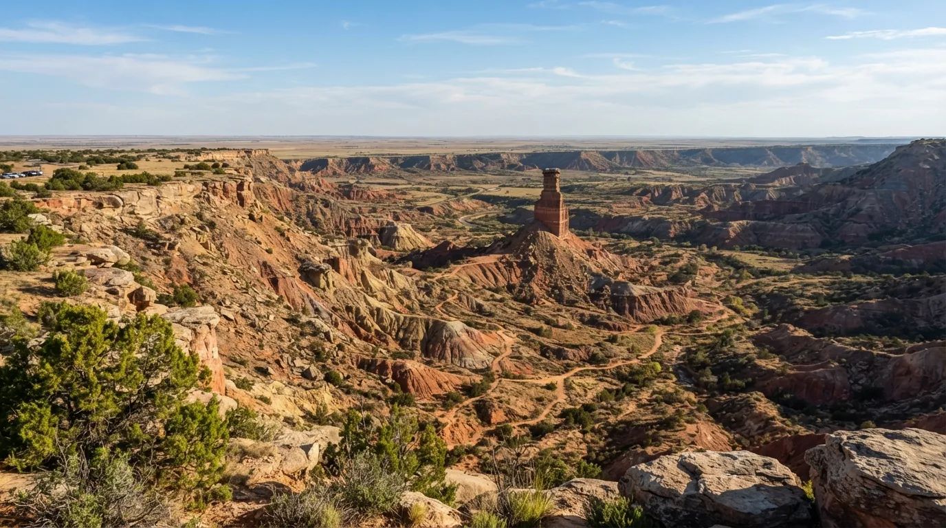
The Panhandle looks flat until the ground gives way. Palo Duro Canyon lies about 24 miles from Amarillo, so it pairs easily with the Cadillacs. The canyon runs about 120 miles long and over 800 feet deep.4 It is often called the second-largest canyon in the United States, though it is much smaller than the Grand Canyon, which is 277 miles long and more than 5,000 feet deep.
The state park opened to the public in 1934, according to Texas Parks and Wildlife.5 A paved scenic drive leads to the canyon floor, with miles of hiking and biking trails. The most popular route is the Lighthouse Trail, roughly six miles round trip, which ends at a tall hoodoo rock you can spot long before you reach it.
#3 – The Top of Texas at Guadalupe Peak
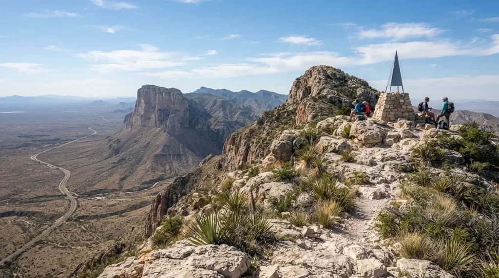
Guadalupe Peak, at 8,751 feet, is the highest point in Texas. It sits in Guadalupe Mountains National Park near the New Mexico line, roughly 110 miles east of El Paso. The summit trail runs about 8.4 miles round trip with a climb of around 3,000 feet, which is a full day for most hikers.6 There is no shortcut, so it is worth it only if your knees and the weather cooperate.
Related Stories From Travelbinger

You do not have to climb it to justify the drive. The limestone face of El Capitan has long served as a landmark for travelers on this stretch of highway. McKittrick Canyon is known for fall color when its maples turn, a surprise in a state people picture as all desert and cattle.
#2 – Big Bend National Park, Hours From Anywhere
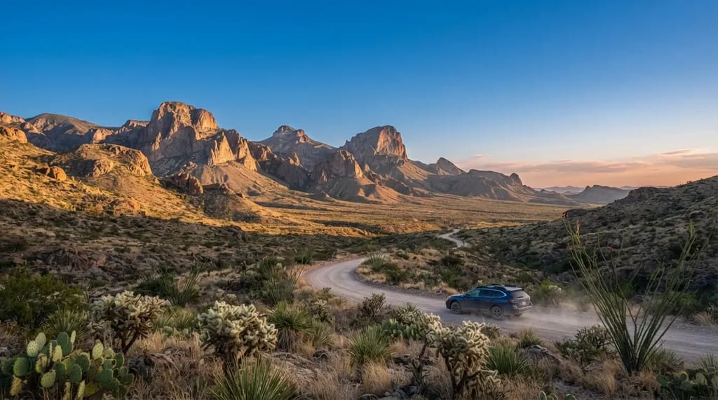
Big Bend National Park covers 801,163 acres, which makes it bigger than the state of Rhode Island.7 The Chisos Mountains rise inside it and are the only mountain range in the country fully contained within a national park.8 The park is home to more than 450 bird species and about 70 types of cacti.
Getting there is the cost. From Midland, the drive is more than three hours. The payoff is the sky: the park sits in the 15,000-square-mile Greater Big Bend International Dark Sky Reserve, and the nearest big city is hours away. The park logged 568,104 visits in 2025. Weather is mildest from November through April, which is the busiest stretch, while summer brings heat and far fewer people.
#1 – The Big Bend State Park Few Visitors See
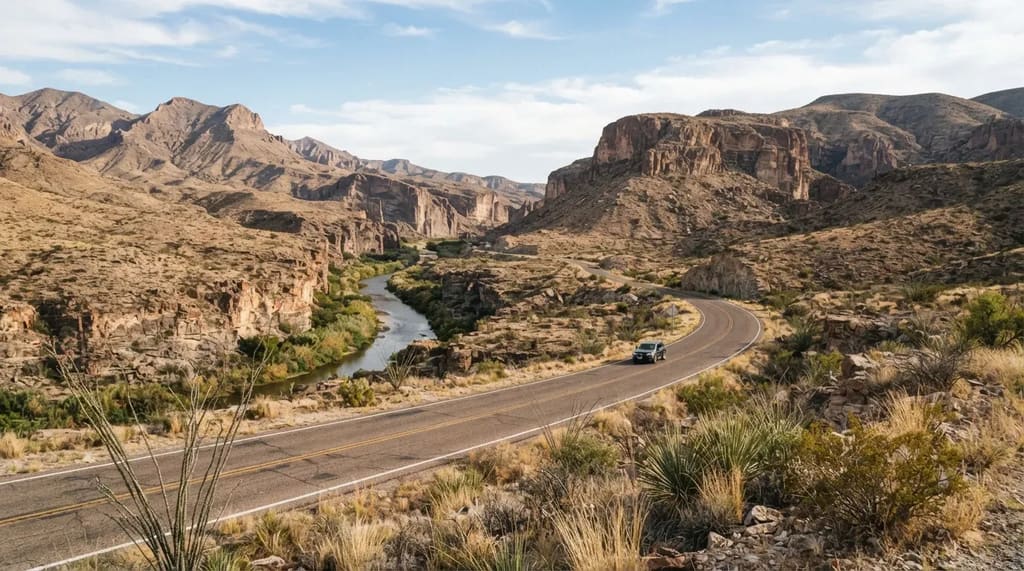
Big Bend Ranch State Park covers 311,000 acres and sits right next door to the national park. Visitors reach it mainly by FM 170, a road that runs along the Rio Grande. It is also an International Dark Sky Park. Presidio, the nearest town, is about an hour south of Marfa, so the art-and-desert stretch of West Texas is already part of the trip.
The visit counts show the difference. The state park recorded 12,451 visits in 2025, compared with 568,104 in the national park, even though the state park is about 40 percent of its size. That is the whole case for it: the corner of Texas that takes the longest to reach has the quietest roads and the most room. The cost is limited services and rough roads, so check with Texas Parks and Wildlife on conditions and permits, and fill your tank and water before you head in.
Quick Compare
- Big Bend National Park: 801,163 acres and 568,104 visits in 2025.7
- Big Bend Ranch State Park: 311,000 acres and 12,451 visits in 2025.
- The takeaway: The state park is roughly 40 percent of the size and draws a tiny fraction of the crowd.
Texas rewards the stops that ask more of the odometer. The roadside photos take twenty minutes and look great on a phone, but the far stops hand you things a screen cannot: a sky with no city glow, a trail with no line, a quiet river road. Next time, count the hours between stops instead of how many you can squeeze in.
- Library of Congress Prada Marfa: https://www.loc.gov/item/2014631032
- TPWD Congress Avenue Bridge: https://tpwd.texas.gov/huntwild/wild/species/bats/bat-watching-sites/congress-avenue-bridge.phtml
- NPS Padre Island Overview: https://www.nps.gov/im/guln/pais.htm
- Texas Governor Palo Duro Canyon: https://gov.texas.gov/film/trail/palo-duro-canyon-state-park
- Texas Parks Palo Duro Magazine: https://tpwmagazine.com/parks/palo-duro-is-the-grand-canyon-of-texas/
- NPS Guadalupe Peak Hike: https://www.nps.gov/thingstodo/gumo_hike_guadalupe_peak.htm
- NPS Big Bend Park Statistics: https://www.nps.gov/bibe/learn/management/statistics.htm
- Big Bend Foundation Document: https://npshistory.com/publications/foundation-documents/bibe-fd-overview.pdf