
Rockstar’s state of Leonida is invented, but one of the first shots in the Grand Theft Auto VI trailer is a long aerial flyover of a bridge that looks a lot like real Florida. Here are 12 real bridges and causeways that echo that look, and you can drive every one of them.
Some charge tolls, some give you nowhere to stop, and one carries a story about a freighter that most drivers never hear. Stay for #1, a span with an older twin you can still walk, but first we start with the plainest bridge on the list.
#12 – Howard Frankland Bridge Across Old Tampa Bay
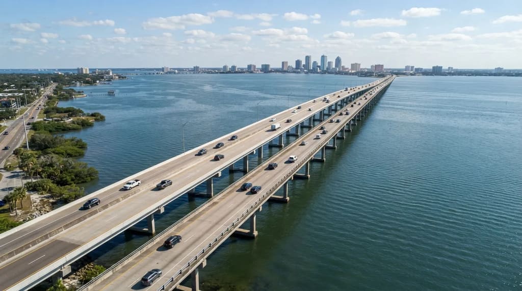
At 15,872 feet, the northbound Howard Frankland Bridge runs just over three miles, carrying I-275 across Old Tampa Bay between St. Petersburg and Tampa. It opened in April 1960 with four lanes, two in each direction, and it remains the most traveled of the bay’s bridges.1
The name trips people up, because the bridge is often written as Howard Franklin, while the man who proposed it was Tampa businessman William Howard Frankland.1 A newer span now sits just north of the old one, so photos taken in different years can show different structures.
Treat it as the crossing you use, not the one you plan a day around. It’s an interstate with no place to pull over, so the bay shows up only in glimpses at highway speed, like a trailer you can’t pause.
The Panhandle has a longer span, by more than half a mile, and it charges a toll to cross. Keep your wallet handy.
#11 – Mid-Bay Bridge Over Choctawhatchee Bay
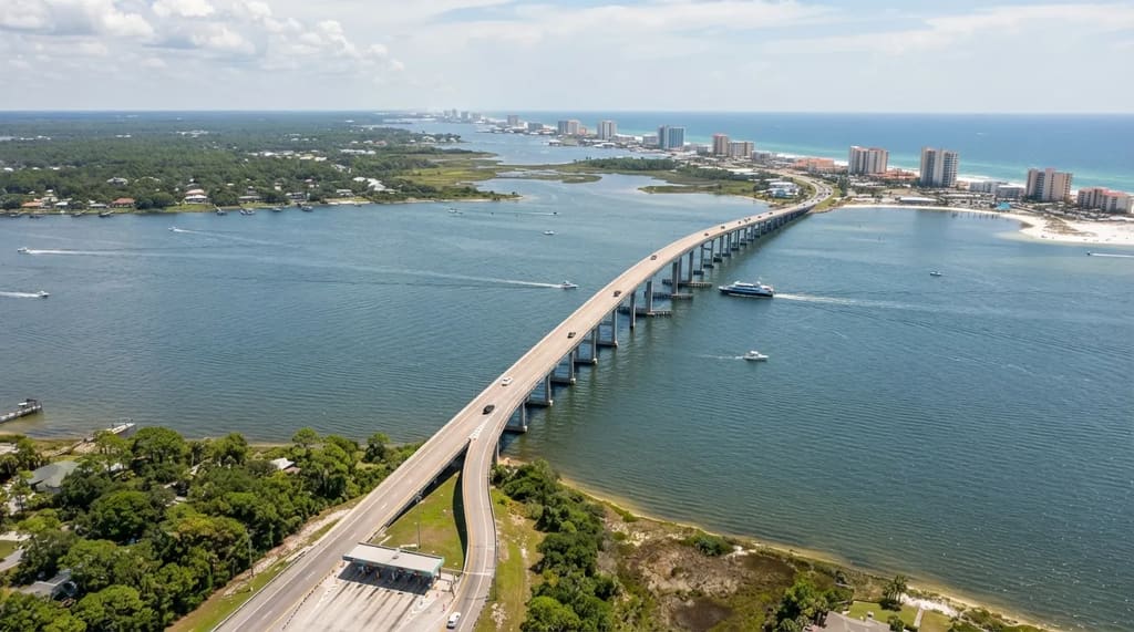
Bring money for this one. The Mid-Bay Bridge carries State Road 293 across Choctawhatchee Bay for 19,267 feet, which is just under 3.7 miles, and it’s a toll crossing.
It opened in 1993, ranks fourth among Florida’s longest bridges, and leaves 64 feet of clearance for boats underneath. That puts it well ahead of the Howard Frankland on length, so the Panhandle’s best-known bay crossing beats Tampa Bay’s workhorse.
Fans who study the trailers tie the game’s Port Gellhorn to the Panhandle’s forgotten coast, and the Mid-Bay sits in the same Panhandle region. It’s a way to see Gulf-side bay country without driving to the far end of the Keys.
Back on the Atlantic side, Miami has a causeway that drivers chose over an older tolled route as soon as it opened.
#10 – The Toll-Free Julia Tuttle Causeway
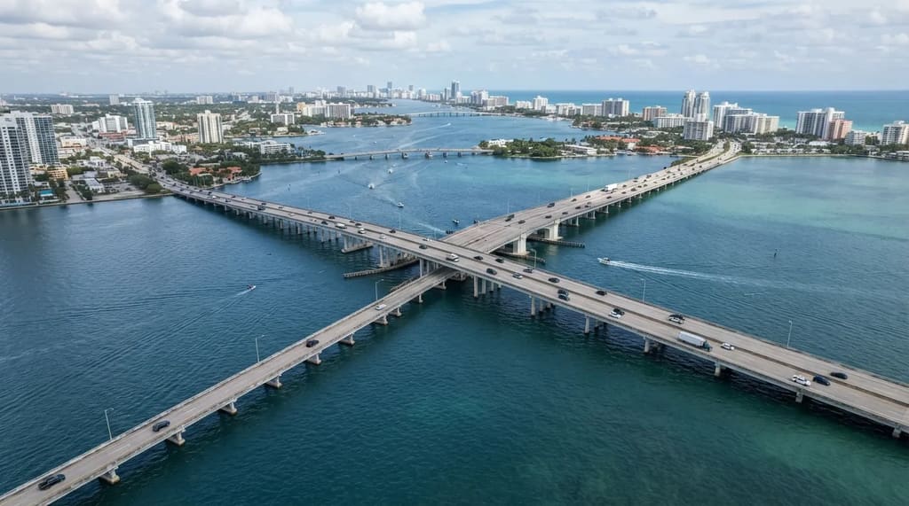
The Julia Tuttle Causeway links 36th Street in Miami with 41st Street in Miami Beach, and it charges no toll. It’s named for Julia Tuttle, often called the mother of Miami, and being free is what changed the city’s traffic habits.
It’s one of five causeways across North Bay, alongside the Broad, John F. Kennedy, Venetian and MacArthur. When it opened in the early 1960s, drivers deserted the Venetian for it almost overnight.
Use it to get somewhere, and don’t count on it for scenery. It carries I-195, so you get highway speed and a free ride, and the best photos of the bay will come from the slower roads on this list.
At a Glance
- Route: 36th Street in Miami to 41st Street in Miami Beach
- Toll: None
- Highway: Carries I-195
- Best for: Getting across fast, not sightseeing
The causeway that lost those drivers is the prettier trip, and its islands were sold before they existed.
#9 – Venetian Causeway and Its Man-Made Islands
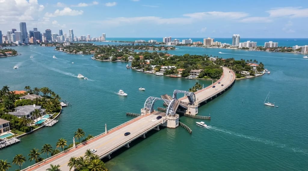
Starting in 1922, buyers paid for underwater lots, and the contracts promised each one an island that had been dredged, filled and improved.2 The islands came first on paper and last in the water.
Work on the causeway began in 1925 and used viaducts, fill and drawbridges, and it was listed on the National Register of Historic Places in 1989.2 It follows the same route as the wooden Collins Bridge of 1913, which opened Miami Beach to development.
Miami-Dade County has moved to replace the 11 original bridges with higher structures, so what you see may change from one visit to the next. Unlike the free Tuttle, it has a toll plaza and no shops or restaurants along it.
The longer causeway south of downtown runs out to a state park, and only 1.2 of its miles are actually bridge.
#8 – Rickenbacker Causeway to Key Biscayne
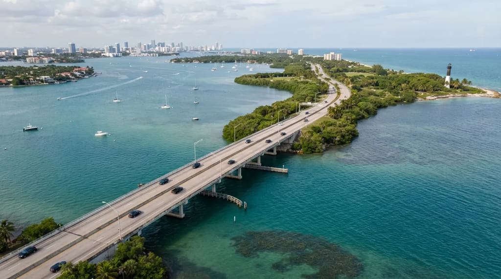
Only 1.2 miles of the Rickenbacker Causeway are bridge, and the other 2.7 miles are roadway built on fill, which is how it was finished in November 1947.3 Filling in the shallow stretches is how a road gets out into a bay without bridging every foot of it.
It’s named for Eddie Rickenbacker, the World War I flying ace who founded and led Eastern Air Lines, and it leads to Virginia Key, Crandon Park, the village of Key Biscayne and Bill Baggs Cape Florida State Park.4 Compared with the Venetian, this one ends at parks and a historic lighthouse instead of at a row of private islands.
My verdict is that it’s the better drive than the MacArthur if you have an afternoon, because you finish at beaches and water instead of at a nightlife district. A toll plaza near the Brickell end charges drivers heading out from Miami, while northbound traffic isn’t charged.
Quick Compare
- Venetian: Work began in 1925, runs past private islands, has no shops or restaurants
- Rickenbacker: Finished in 1947, ends at parks, beaches and a historic lighthouse
- Both: Charge a toll in at least one direction
Cross the state to Tampa Bay, where one bridge’s main span rises high enough to clear a shipping channel.
#7 – Sunshine Skyway, 430 Feet Above Tampa Bay
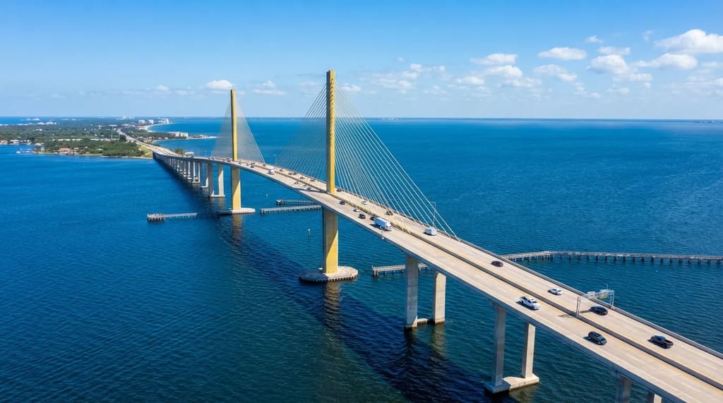
Before the first Sunshine Skyway opened in 1954, drivers who wanted to get across Tampa Bay faced a trip of about 50 miles around it. That detour explains why Floridians treat this bridge as a landmark.
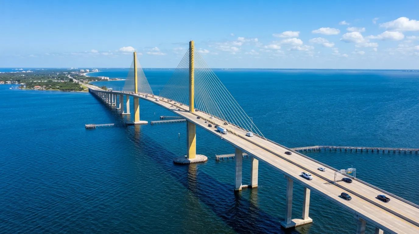
The bridge you cross today opened on April 20, 1987, and its two yellow cable-stayed towers rise 430 feet. It runs about four miles across the mouth of Tampa Bay, connecting Pinellas County to the south shore.
It replaced the 1954 bridge after the freighter Summit Venture struck a support column on May 9, 1980, and 1,200 feet of the old bridge fell into the water, killing 35 people.5 Every driver on it today is crossing the answer to that day.
If you want one bridge for the height alone, make it this one instead of the Howard Frankland, because the open water below is what you came for. Leftover approaches of the 1954 bridge now serve as fishing piers, a quiet reminder beside the traffic.
#6 – Card Sound Bridge, the Back Door to Key Largo
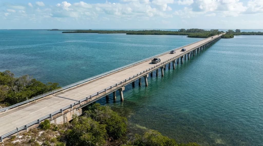
The Overseas Highway isn’t the only road into the Keys. The Card Sound Bridge connects the mainland near Homestead to the northern part of Key Largo.
That gives you a second way in, and it means you can drive down one road and come back on the other. The toll on the bridge buys you a different approach to the same islands.
Take one road down and the other back. I’d call that worth the toll on its own, since driving the same road twice wastes half the scenery.
Once you’re on the Overseas Highway itself, one bridge runs nearly two and a half miles and still isn’t the longest on the road.
#5 – Long Key Bridge, Nearly 2.5 Miles Long
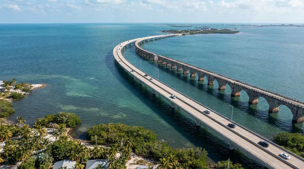
Nearly two and a half miles long, the Long Key Bridge is the second longest on the Overseas Highway, behind only the Seven Mile Bridge. It’s also called the Fascell Bridge.
The current bridge opened in 1982 as part of a modernization that replaced the aging bridges originally built for the Overseas Railroad. You’re driving a late-twentieth-century highway over a route first cut for trains.
It replaced the parallel Long Key Viaduct, which carried trains from 1907 to 1935 and was then repurposed for highway use. That railroad-era viaduct was listed on the National Register of Historic Places on August 13, 1979, together with the original Seven Mile Bridge and the Bahia Honda Rail Bridge.
Another structure on that 1979 list began as a railroad bridge, and a state park lets you see why it matters.
#4 – Bahia Honda Rail Bridge, Built for Trains
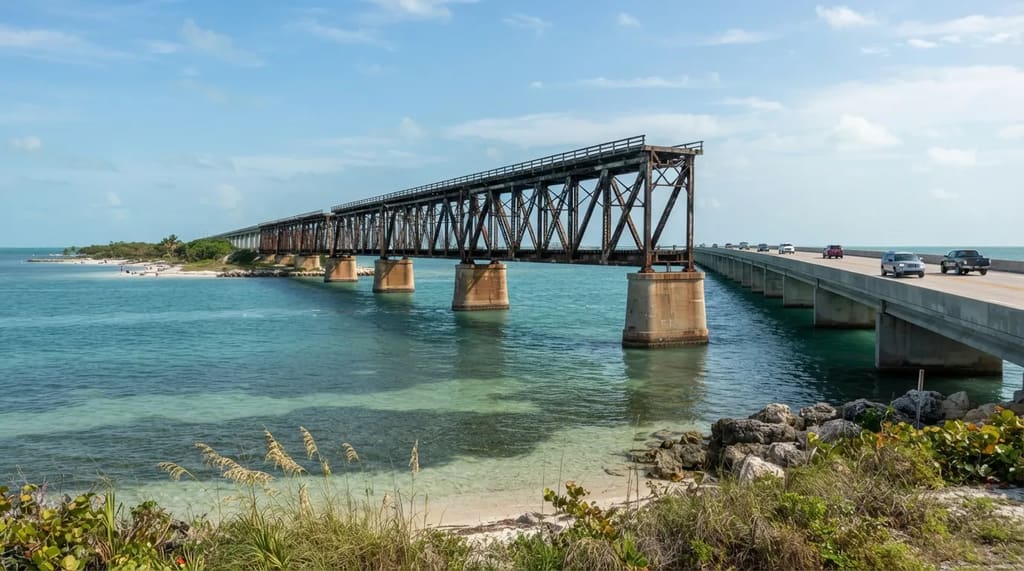
Some of the bridges you cross in the Keys began life carrying trains, and the Bahia Honda Rail Bridge is one of them. It sits beside Bahia Honda State Park, where you can look at it from land.
The 1935 Labor Day hurricane ended the Keys railroad, and that storm decided what the road would look like. The line was sold to the federal government, which turned the railroad’s route and bridges into a road for cars.
That is why this old steel span matters. It was built for trains, carried drivers for years, and was later outdone by a wider highway bridge beside it.
The park gives you the best view of the old structure against the water, with a lookout that lets you see how it sits next to the newer road. Next, we head back to Tampa Bay for a causeway that offers the one thing the Howard Frankland never did: places to stop.
#3 – Courtney Campbell Causeway, the Tampa Bay Crossing You Can Stop On
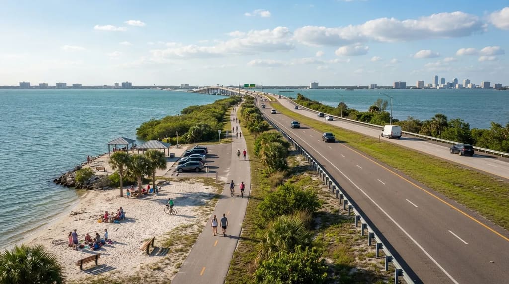
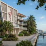
The Courtney Campbell Causeway is the Tampa Bay crossing that finally lets you pull over. It carries State Road 60 between Tampa and Clearwater over Old Tampa Bay, and it charges no toll.
It first opened in 1934 and now carries a Florida Scenic Highway designation. Beach areas and picnic spots line the route, and a trail runs alongside for walkers and cyclists.
Compare that with the interstate down the bay, where the water is a blur outside the window. Here you can park, step out and let the bay slow your day down.
Related Stories From Travelbinger
Why It Stands Out
- Stopping allowed: Beach areas and picnic spots along the route
- No toll: Free to cross on State Road 60
- Designation: A Florida Scenic Highway since it earned the title
- On foot or bike: A trail runs alongside the road
Because the road runs west toward Clearwater, you can aim for sunset and watch the sky do the rest. The next causeway on the list is just as pretty, but it has a harder story attached.
#2 – Sanibel Causeway, the Only Road to an Island
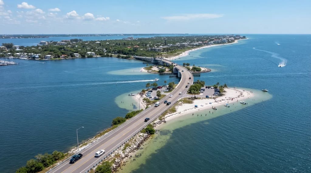
The Sanibel Causeway is the only road to Sanibel Island, and it makes the trip feel like crossing into another world. It runs roughly three miles from Punta Rassa near Fort Myers, uses three bridges linked by two man-made islands, and charges a toll to cross.
It opened in 1963, and it changed Sanibel from an island you reached by boat into one you could drive to.6 The low roadway keeps you close to the water, with Gulf and bay on both sides.
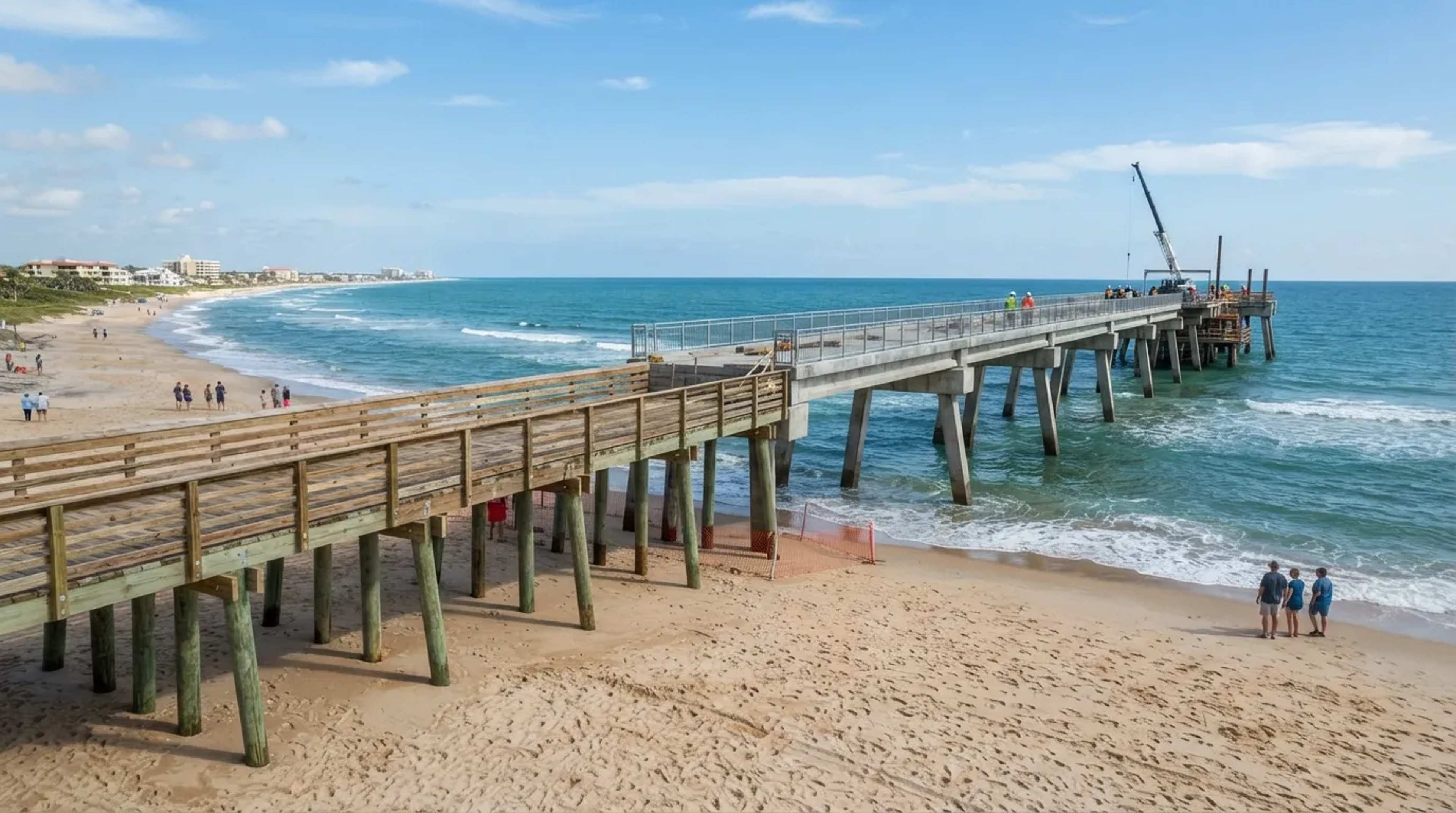
Then Hurricane Ian arrived in September 2022 and tore away sections of the roadway, cutting the island off from the mainland.6 Crews restored a temporary road within weeks, and permanent repairs followed.
That is why this one lands so high. The causeway islands in the middle offer public beach and fishing access, so you can stop and see a road that was broken and put back together. The best bridge on the list is almost three times as long.
#1 – Seven Mile Bridge, the Longest Span on the Overseas Highway
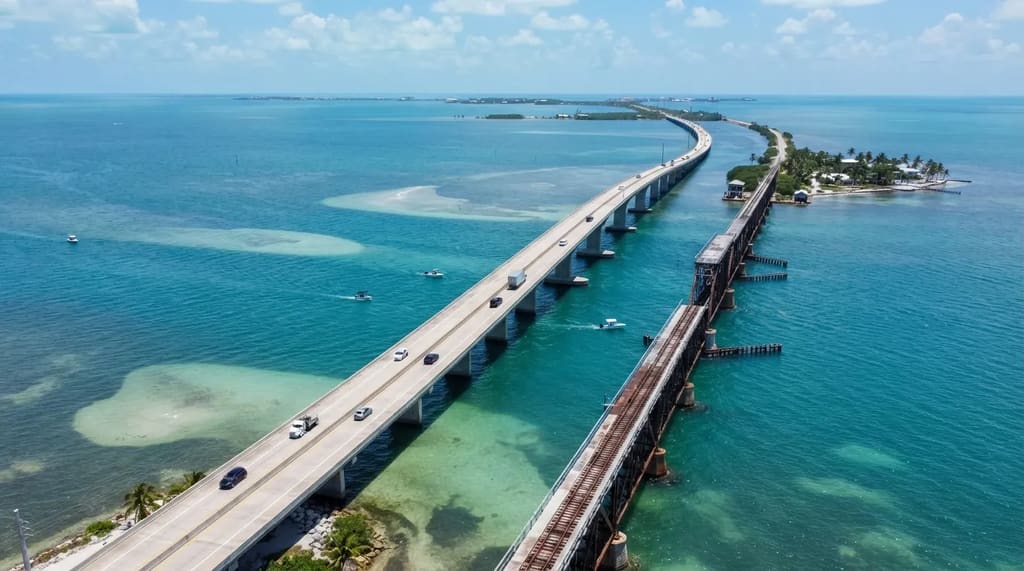
The Seven Mile Bridge runs 35,862 feet, or about 6.8 miles, from Knights Key in Marathon to Little Duck Key. It’s the longest bridge on the Overseas Highway, and the current span opened in 1982.7
Halfway across, the road rises in a long hump over Moser Channel so boats can pass underneath. From the top, there’s water in every direction and almost nothing else.
Right beside it is the older twin, built for Henry Flagler’s Overseas Railroad and finished in 1912. It carried trains and then cars until the new bridge took over, and about 2.2 miles of it, from the Marathon end toward Pigeon Key, are open to walkers and cyclists.7 8
Fast Facts
- Length: 35,862 feet, about 6.8 miles
- Current span: Opened in 1982
- Older twin: Finished in 1912 for the Overseas Railroad
- Walkable stretch: About 2.2 miles toward Pigeon Key
That’s why this is #1. You can drive the modern span, then walk the original and look across at the one that replaced it, with little shade and plenty of wind. Bring water.
Rockstar invented Leonida, but Florida built the real thing, one toll booth, hurricane and railroad at a time. From the plain interstate at #12 to the old railroad bridge you can walk at #1, these twelve crossings show how far people will go to put a road over water.
Pick one, or link several, and bring cash for the tolls. The best part of any bridge is the moment the land drops away behind you.
- Howard Frankland Bridge: https://en.wikipedia.org/wiki/Howard_Frankland_Bridge
- Venetian Causeway Historic Preservation: https://www.historicpreservationmiami.com/venetian.html
- Rickenbacker Causeway Overview: https://en.wikipedia.org/wiki/Rickenbacker_Causeway
- Miami-Dade Rickenbacker Causeway: https://www.miamidade.gov/global/transportation/public-works/rickenbacker-causeway.page
- Sunshine Skyway Britannica: https://www.britannica.com/place/Sunshine-Skyway-Bridge
- Sanibel Causeway Restoration: https://www.constructiondive.com/news/sanibel-causeway-restoration-complete-hurricane/749099/
- Seven Mile Bridge Britannica: https://www.britannica.com/place/Seven-Mile-Bridge
- Old Seven Mile Reopens: https://www.cbsnews.com/amp/miami/news/keys-old-seven-mile-bridge-reopens-to-walkers-runners-bicyclists/